
Understanding Nar Phu Valley (History, People, Landscape & Trails)
Nar Phu Valley is a canyon surrounded by barren highlands and mountains rising over 6,000 meters. It lies in the Manang district and falls under Annapurna Conservation Area. It is also part of the Trans-Himalayan zone. The Government of Nepal has categorized this region as a restricted area because of its proximity to Tibet, remoteness, and ecological and cultural sensitivity.
Legend says the inhabitants of Nar Phu settled in this secluded valley over 1,000 years ago after fleeing persecution by a Tibetan king. Today, there are six settlements in the region: Meta (Methang) Village, Chyakhu Village, Kyang Village, Phu Village, Nar Phedi, and Nar Village.
The region is also home to one of the most important Buddhist religious sites: Tashi Lhakhang Monastery. Many Buddhist pilgrims, especially monks, visit this place from around the world.
Nowadays, Nar Phu Valley is popular among trekkers as a less-crowded and remote trail. The rugged terrain gives it an alien-like environment, which makes it especially appealing to experienced and adventurous trekkers. If you would like to learn more about trekking in this region, you can read our Nar Phu Valley Trekking Package.
Villages in Nar Phu Valley
In this section, I will briefly describe about all the villages located in the Nar Phu Valley:
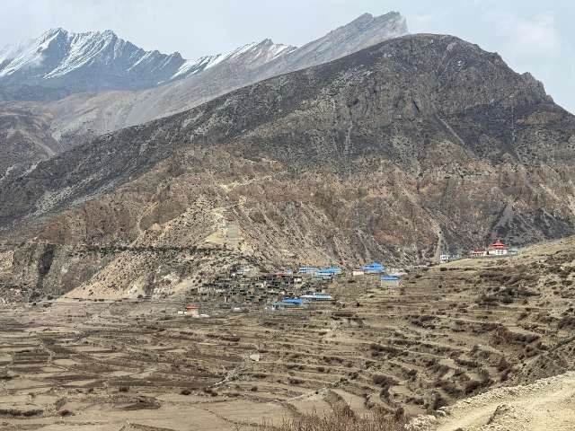
Nar Village
Nar Village lies north of Pisang Peak at an altitude of 4,150 meters. On the west side of Nar, a stream of water flows from the hydropower plant built among the rugged rocks. There are terraced fields for farming in front of the village.
About 90% of the houses in Nar Village are still made of mud in the traditional way. These houses are tightly clustered together with colorful prayer flags fluttering above each house. Most of them share the same design with a two-storied structure. The ground floor is used to keep horses and goats, while the second storey is used as the sleeping room and kitchen.
Behind the village, there is a large open area. You can find many horses grazing here. This section is also a suitable spot for practicing horse riding or galloping with horses in the Himalayas.
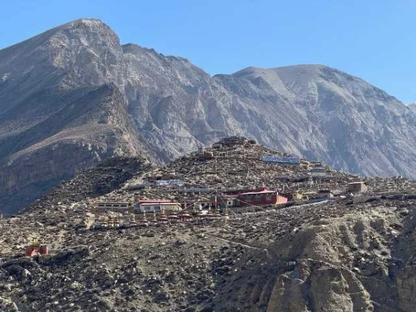
Phu Village
Phu Village (altitude: 4,050 meters) is perched on a cone-shaped, rugged hill rising approximately 60 meters above Phu Khola. A Buddhist monastery, named Yul Gompa, is situated at the top of the hill, overlooking the valley and its people.
The houses feature flat roofs and stone walls. The village is compact with around 50 households tightly clustered together within a 63-meter radius.
In recent years, new houses have sprung up beyond the cone-shaped hill and across the Phu River. Unlike the traditional houses, these new homes have wider rooms and a separate kitchen.
The village is truly hidden because it is very difficult to notice. Trekkers will have a hard time spotting the village even from just 200 to 300 meters away, because of how well it blends with the surrounding barren landscape.
On the northern side of Phu Village, across the Lodal stream, one of the religiously significant Buddhist monasteries is present: Tashi Lhakhang Monastery.

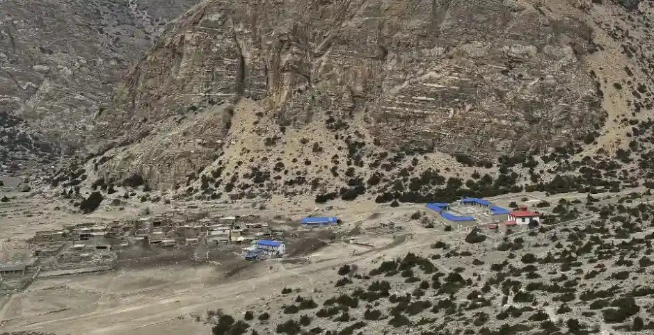
Meta Village
Meta Village is the first settlement that trekkers encounter after entering Nar Phu Valley. It lies at an altitude of 3,560 meters.
This place was previously used as farming land by villagers of Nar. As trekking routes opened in this area, some families from Nar village moved to Meta to earn extra income by hosting travelers. Today, the village has around 10 houses, built recently to welcome and serve trekkers.
And about the name, does it sound local to you? Probably not. Originally, the village was called Methang. Later, foreign tourists found it difficult to pronounce “mee-tha-an-g”. After repetitive use, the name evolved into “Meta”.

Chyakhu Village
Chyakhu Village lies at the northwestern base of Mount Kang Guru at an elevation of 3,735 meters. Similar to Meta Village, Chyakhu was used for farming and as a seasonal winter settlement by families from Nar Village.
Today, there are around four houses in the village. There is a vast open space in front of the village where cattle and yaks graze freely. It is also home to the Narpa Bhumi Rural Municipality Administration Head Office.
On the western side of the village, trekkers can still find the remnants of ancient stone houses and sheds. On the same side, across the Nar river, the majestic Chhomochomo hill catches the eyes of many trekkers.
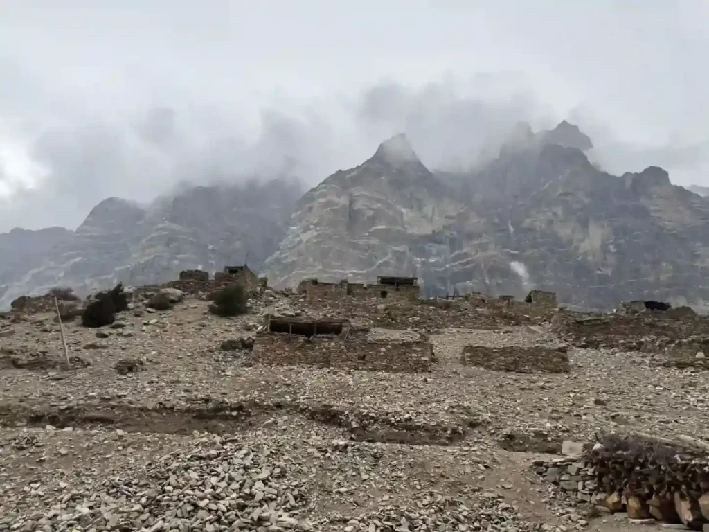
Kyang Village
Kyang Village lies at the southwestern base of Mount Gyaji Kang at an elevation of 3,850 meters. On its southern edge, remnants of ancient houses are still intact. Families from Phu once stayed here during winter to look after cattle and houses. Villagers also used to live here during sowing and harvesting.
Today, Kyang is a small hamlet with three houses. Most of these houses are built to serve trekkers staying a night in the village or as a lunch stop before walking toward Phu Village.
Like the other villages mentioned above, this village is also surrounded by rugged hills and mountains.
History of Nar Phu Valley
Arrival & Early History
According to local oral traditions, the ancestors of Nar Phu’s inhabitants arrived in Nar Phu Valley from Tibet at least one thousand years ago. At that time, a Tibetan king tried to suppress religious activities and was persecuting his followers. To save themselves, some families fled Tibet and settled in the isolated Nar Phu region, hidden deep in the Himalayas.
Historical records and papers, such as “Social Change in the Hidden Kingdom of Nepal’s Himalayas: A Case Study of the Baden,” mention that a custom of human sacrifice was practiced in Nar Phu Valley long ago (12 girls were sacrificed every three years). This tradition eventually led to entire villages becoming depopulated, so the people decided instead to sacrifice yaks, and later goats. Over time, they converted to Buddhism and abandoned these killings.
Tashi Lhakhang Monastery
Around the 13th century, one of the revered Buddhist masters, Lama Karma Sonam Rinpoche, arrived in the valley and built the Tashi Lhakhang Monastery on the northern hill of Phu Village.
Today, traces of the original monastery remain carved into the cliff of a barren hill across from Phu Village. A new monastery, adorned with Buddhist decorations, has been constructed about 20 to 30 meters above the original site.
Many Buddhist pilgrims from around the world visit this sacred monastery.
Lost Valley of Nepal
Nar Phu Valley is known as the ‘Lost Valley of Nepal’ because it was missing from early official maps. The Kingdom of Nepal did not originally document the existence of the Nar Phu villages. Later, during the 20th century, King Mahendra officially incorporated the valley into Nepal with the help of neighboring villages.
Recent History
The valley remained isolated for much of its existence. Unlike other Himalayan villages, Nar Phu rarely benefited from Tibetan salt trading.
Before the 18th century, Nar Village is believed to have been the capital of the powerful Ghale King, who ruled the entire Manangbhot region. Due to constant power struggles with the neighboring Lamjung state, the kingdom gradually lost its influence. By the 20th century, records show that Nar Phu’s economy and lifestyle were largely dependent on Nyesyang, with more than 80% of trading at that time being done with Nyesyang Village.
Later, as people from Nar Phu Valley began moving abroad for better income and the valley opened to trekkers in 2003, the region experienced steady economic growth. Today, the community is more empowered than ever, with many children pursuing education in Kathmandu and beyond.
Geography of Nar Phu Valley
Nar Phu Valley starts at an elevation of 3,000 meters and rises up to 7,140 meters. The valley covers an area of 837.5 square kilometers and is encircled by towering peaks and rugged highlands from all four sides.
- To the north, the valley borders Tibet with notable peaks like Mt. Ratna Chuli and Mt. Lugla.
- The southern side is marked by Pisang Peak, and beyond Pisang Peak, trekkers can see views of the Annapurna range.
- On the eastern horizon stands Mt. Himlung, Mt. Gyaji Kang, Mt. Nemjung, and Mt. Kang Guru.
- The western side is the home to Chulu range, Teri Himal and Purbung Himal, along with dramatic rocky highlands such as Chhomchomo hill and Yongmoso hill.
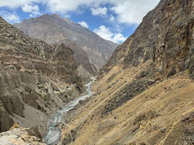
Nar Phu Valley lies in the Trans-Himalayan zone and is characterized by arid terrain similar to a desert. It receives very little rainfall throughout the year as the valley is situated in a rain shadow area. Hence, it is considered one of the ideal regions for trekking during the monsoon, provided the vehicle roads remain open.
The valley is also home to some of the lesser-known glaciers, such as Pangri Glacier, Kang Guru Glacier, and Gyaji Kang Glacier. According to local accounts, much of these glaciers have receded significantly in recent decades due to climate change.
Administration and Demographics
The Nar Phu Valley falls under the jurisdiction of the Narpa Bhumi Rural Municipality, which manages the region’s local development and governance
It is the least populated local administrative region of Nepal, with a population of just 396 people, according to the 2021 Nepal census. Most of the families have the Lama surname, with a few also belonging to the Ghale Gurung, and Sherpa communities.
In 1971, the total population of the region was 850. The current population has shrunk by more than 50%, after years of migration in search of better opportunities. Thanks to the revived tourism industry, many families have started returning to and staying in the Nar Phu Valley.
Flora & Fauna
Nar Phu Valley is classified as an inner valley on the basis of climatic and vegetational divisions. Inner Valleys refer to the region lying on the northern side of the Himalayan ranges. The geographical position causes the region to receive significantly less rainfall compared to the southern part of the Himalayas. Other examples include Lantang region, Manaslu region and Upper Mustang.
In this section, I have described the type of forest, ecosystem, and living beings found in Nar Phu Valley:
Vegetation
As trekkers ascend through Nar Phu, the vegetation shifts through three distinct ecological zones:
- Upper Temperate Zone (2,700–3,100 m): Rhododendron forest (Rhododendron arboretum, R. barbatum), mixed broadleaved forest, and coniferous trees.
- Subalpine Zone (3,000–4,200 m): Abies spectabilis forest, Betula utilis forest, Caragana steppe, oak forest, fir forest, and Rhododendron forest (Rhododendron campanulatum, R. thomsonii, R. campbellianum).
- Alpine Zone (4,000–5,000 m): Junipers, Hippophae rhamnoides, Cotoneaster, alpine meadows, and shrubby Rhododendrons.
Wildlife
Nar Phu Valley is a protected territory under the Annapurna Conservation Area Project (ACAP). Thanks to strict anti-poaching regulations, the valley has become a thriving sanctuary for some of the world’s endangered animals.
Animals found in Nar Phu Valley:
- Snow Leopard
- Clouded leopard (at lower altitudes up to 3,000 m)
- Eurasian Otter
- Blue Sheep
- Wild Yak
- Rabbits: Woolly Hare & Indian Hare
- Himalayan Marmot
- Monkeys: Nepal Gray Langur
- Chinese Pangolin
- Spotted Giant Flying Squirrel
- Himalayan Wolf & many more.
Birds found in Nar Phu Valley:
- Cheer Pheasant
- Chukar Partridge
- Common Hoopoe
- Crested Kingfisher
- Rock Eagle-Owl
- Himalayan Griffon
- Golden Eagle & many more.
Trekking in Nar Phu Valley
Nar Phu Valley is one of the lesser-known trails in Nepal. The valley features towering rocky highlands, beautiful snow-capped mountains, glaciers, clear rivers and streams, and centuries old villages. The trail is slowly gaining popularity as a less crowded, remote, and otherworldly destination.
At Travel To Nepal, we operate a variety of trips in Nar Phu valley, including horse riding, yoga trekking, combined Annapurna Circuit treks, easy-paced options, and more. If you are interested in trekking in this region, please send us a message; we will design a customized itinerary that meets your specific requirements.
Frequently Asked Questions
Where is Nar Phu Valley located?
Why is the Nar Phu Valley considered a restricted area?
What are the main villages in the Nar Phu Valley?
What is the historical significance of the Tashi Lhakhang Monastery?
Why is the Nar Phu Valley known as the “Lost Valley of Nepal”?
What is the history of the Nar Phu Valley’s inhabitants?
What is the climate of the Nar Phu Valley?
What are the different vegetation zones in the Nar Phu Valley?
- Upper Temperate Zone (2,700–3,100 m): Rhododendron and mixed broadleaved forest.
- Subalpine Zone (3,000–4,200 m): Abies spectabilis and Betula utilis forest.
- Alpine Zone (4,000–5,000 m): Junipers and shrubby Rhododendrons.
Contact Form
You can send your enquiry via the form below: