Best Photos from Langtang Trek: Mountains, Nature and Villages
Our Travel To Nepal team has compiled 11 photos taken during the Langtang Trek. Believed to be one of the most beautiful valleys in the Himalayas, I hope the photos here will captivate our readers. The images show mountains, green hills, rugged terrain, rivers, wildlife, villages, and cultural features of the Langtang region. Each photo includes a brief description
Enjoy Langtang Trek Pictures!
Table of Contents
Picture of Mountain Views during Langtang Trek
This section includes the photos of mountain ranges visible during Lantang Valley Trek.
The Langtang Trek in Nepal’s Langtang Valley includes views of mountains, such as Langtang Lirung, Ganchenpo, Naya Kanga, Dorje Lakpa, Yala Peak, Yubra Peak, Langshisa Ri, and Langtang II. The Langtang Valley also includes glaciers that trekkers can see, including Langtang Lirung Glacier, Shalbachum Glacier, and Yala Glacier.
Mountains seen from Tserko Ri
The view is from the top of Tserko Ri (4,985 m/16,355 ft), the highest point on the Langtang Trek.
The picture was taken from the summit of Tserko Ri. The view faces east. Visible snow-covered mountains include Langshisha Ri (6,560 m/21,552 ft), Dorje Lakpa (6,966 m/22,855 ft), Ganchenpo (6,387 m/20,955 ft), and Ponggen Dopku (5,928 m/19,449 ft).
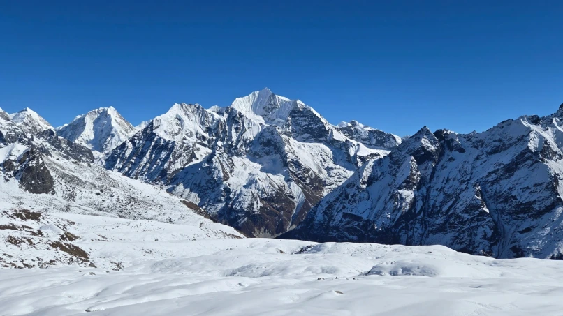
Mountains seen from Kyanjin Ri
The view is seen while trekking between Kyanjin Ri Lower Viewpoint (4,400 m/14,436 ft) and Kyanjin Ri Upper Viewpoint (4,773 m/15,659 ft).
The photo shows the western side of Kyanjin Ri. The mountain on the right is Langtang Lirung (7,234 m/23,734 ft). The mountain on the left is Naya Kanga (5,857 m/19,216 ft). The brown area between these mountains is the lower elevation of the Langtang Valley. The Langtang River flows through this area. Kyanjin Gompa, Langtang Village, and Thangshyap are located in this section. Kindly note that the views from Kyanjin Ri and Tserko Ri are similar.
Nature Photos of Langtang Valley
This section includes images of natural features visible on the Langtang Trek, including green high hills, the Langtang River, temperate forests, and wildlife found in the Langtang region.
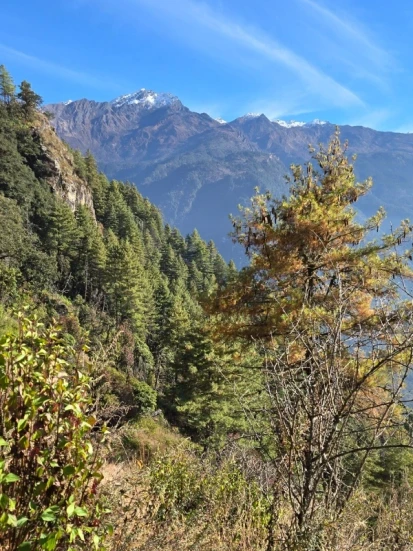
Green Hills from Langtang Trek
The view shows continuous green hills along the trekking route from Syabrubesi to Sherpagaon. Several hills visible in the photo rise above 4,000 meters.
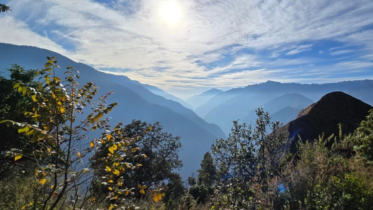
The above picture is a proof that the beauty of Langtang Valley is more than mountain landscapes. The continuous, gently sloping hills across the valley look equally breathtaking.
Rugged Topography of Langtang
The rugged terrain of the Langtang Trek becomes visible at Ghodatabela. The area features steep and uneven landscapes.
The image shows the terrain just before Kyanjin Gompa. The area features rugged and raw landscapes, and it feels otherworldly.
Lush Forest of Langtang Valley
Trekkers pass through sub-alpine and temperate forests in the Langtang Valley. The forests include Rhododendron, Blue Pine, and Larch trees.
The photo shows a sloping fir forest in the Langtang Valley, along with other tree species.
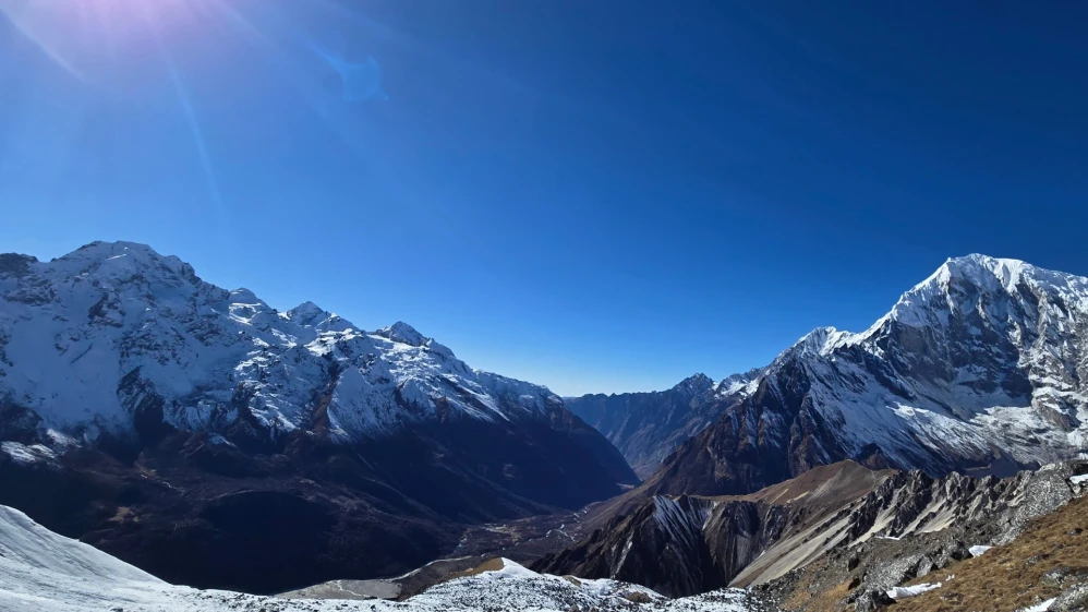
Turquoise Langtang River
The Langtang river originates from the glaciers of Langtang valley and cuts between the valley. The turquoise color gives it a unique touch.
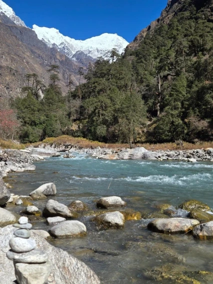
The image was taken from Riverside, a common lunch point on day 3 of the Langtang Trek. It includes the Langtang River, green Larch forests, rugged highlands, and the snow-capped Langtang Range.
Wildlife in Langtang Region
Trekkers often encounter wildlife on the Langtang Trek. Species found in the region are Red Panda, Snow Leopard, Grey Langur, Yellow-throated Marten, Himalaya Vulture, Himalaya Tahr, and Musk Deer.
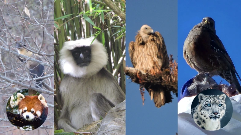
The image is a collage of wildlife seen in the Langtang Valley. It includes Yellow-throated Marten, Grey Langur, Himalaya Vulture, Red Panda, and Snow Leopard.
Pictures of Villages and Life in Langtang Region
This section shows the photos of different villages (Langtang Village and Kyanjin Gompa), domesticated animals (Yaks and Horses), and Buddhist culture in Langtang Valley.
Langtang Village
The new Langtang Village is built above the site of the previous village that was destroyed.
The village is now constructed with concrete structures.
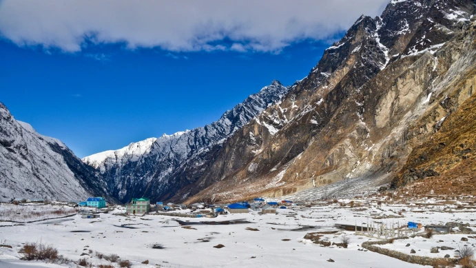
The photo shows Langtang Village after snowfall. The village is snow-covered, with rugged highlands nearby.
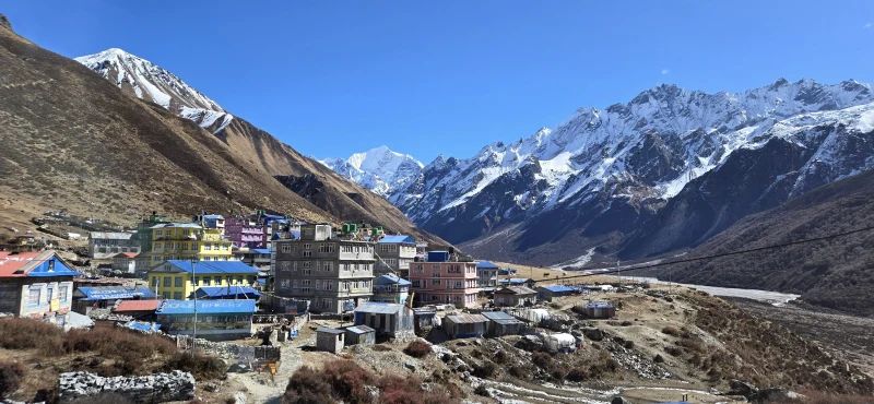
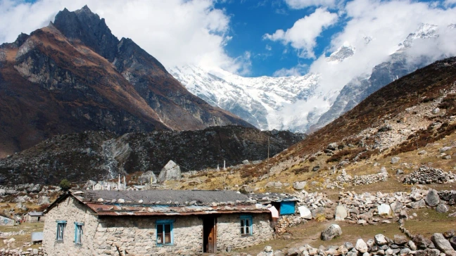
Kyanjin Gompa Village
Kyanjin Gompa Village is the last settlement on the Langtang Trek. The village is surrounded by mountains, and the houses are painted in various colors.
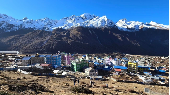
The image shows a bird’s-eye view of Kyanjin Gompa Village from 30 meters uphill on the way to Kyanjin Ri. The snow-capped Naya Kanga is visible ahead, with rugged terrain surrounding the village.
Yaks Grazing
The people in Langtang valley used to keep yaks for food and milk purpose. Today, trekkers can find yaks grazing nearby the langtang trail.
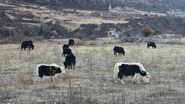
The photo shows yaks grazing with their newborns about 30 minutes’ walk from Langtang Village. The Langtang Valley has some flat fields for yaks and horses to graze.
Buddhist Stupa
Langtang Valley is mainly inhabited by Himalaya Buddhist Lama and Sherpa. They have built stupas, statues and monastery in the remotest part of the mountains.
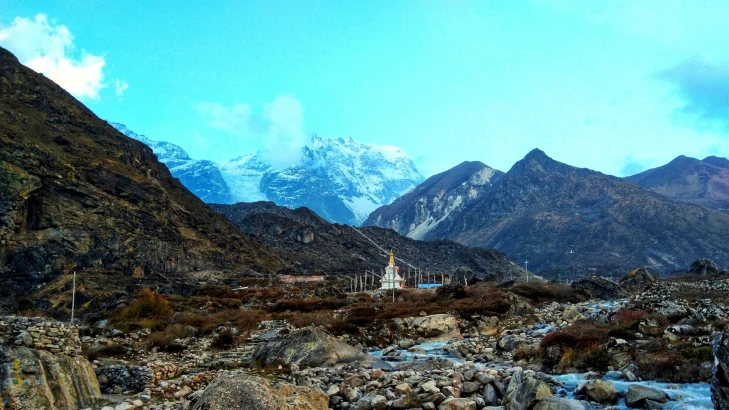
The picture above shows a white stupa located below the Langtang Massif, with the Langtang River flowing beneath it. The surrounding terrain is barren and rocky.
Final Words
The photos in this blog highlight key features of the Langtang Trek. From Tserko Ri and Kyanjin Ri, there are 360-degree views of surrounding mountains. The trail mostly follows the Langtang River and passes through lush temperate forests at lower elevations. The region is home to endangered species such as Red Panda, Snow Leopard, and Grey Langur.