Comprehensive Information About Kanchenjunga Region
The Kanchenjunga Region is a 2,035-square-kilometer high-altitude expanse in eastern Nepal that hosts the world’s third-highest mountain. Mountaineers and trekkers navigate this remote sector to access the Kanchenjunga Conservation Area (KCA), a transboundary ecosystem sharing borders with India’s Khangchendzonga National Park and Tibet’s Qomolangma National Nature Preserve. Unlike the commercialized trails of Everest or Annapurna, this region demands self-sufficiency, as infrastructure remains basic and permits require restricted-area authorization.
The landscape transitions from subtropical lowlands at 1,200 meters to glacial peaks above 8,000 meters, creating a vertical biodiversity corridor. Indigenous communities, including the Limbu, Sherpa, and Rai people, manage these lands through the Kanchenjunga Conservation Area Management Council (KCAMC), a community-based organization established in 2006. This management model ensures that tourism revenue directly supports local conservation and infrastructure projects.
Trekking Trails in Kanchenjunga Region
Trekkers access the Kanchenjunga massif primarily through three distinct routes: the North Base Camp trek, the South Base Camp trek, and the combined Kanchenjunga Circuit.
Kanchenjunga Circuit Trek
Kanchenjunga Circuit Trek is the most comprehensive and demanding option, combining both base camps for a full circumnavigation of the massif. It usually 19 days and involves crossing high mountain passes like the Sele La (around 4,600m), Mirgin La, and Sinion La. This route offers the best of both worlds: the north face’s stunning views and the south side’s cultural richness and Yalung Glacier views.
North Base Camp (Pangpema)
The trail to North Base Camp (5,143m) begins at steep lower elevations and ascends along the Ghunsa Khola river. Hikers typically take 17 to 20 days to complete this route, starting from Taplejung and passing through the villages of Chiruwa and Lelep. At Pangpema, the landscape opens to reveal the massive north face of Kanchenjunga (8,586m) and the Wedge Peak. This route suits trekkers seeking high-altitude exposure without technical climbing, though acute mountain sickness remains a risk above 3,000 meters.
South Base Camp (Oktang)
The South Base Camp trail leads trekkers to Oktang (4,730m) via the Yalung Glacier. This route offers close-up views of the southwest face of Kanchenjunga and the Jannu Himal. Trekkers often combine this southern approach with the northern route by crossing the Sele La Pass (4,290m). The pass connects Ghunsa in the north to Tseram in the south, allowing a full circuit of the massif in approximately 22 to 25 days.
The Great Himalayan Trail Section
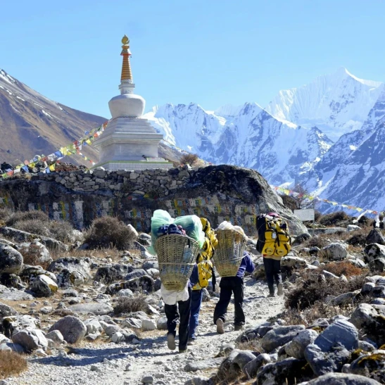
The Kanchenjunga section of the Great Himalayan Trail (GHT) challenges experienced hikers with technical passes like the Lumbasumba La. This route connects the Kanchenjunga region to the Makalu region, traversing isolated valleys such as Olangchung Gola. Only fully equipped expeditions with camping gear attempt this crossing due to the lack of teahouse infrastructure between Thudam and the Arun Valley.
Major Mountains in Kanchenjunga Region
The Kanchenjunga massif anchors a cluster of peaks that rise above 7,000 meters, forming a giant cross-shaped ridge system.
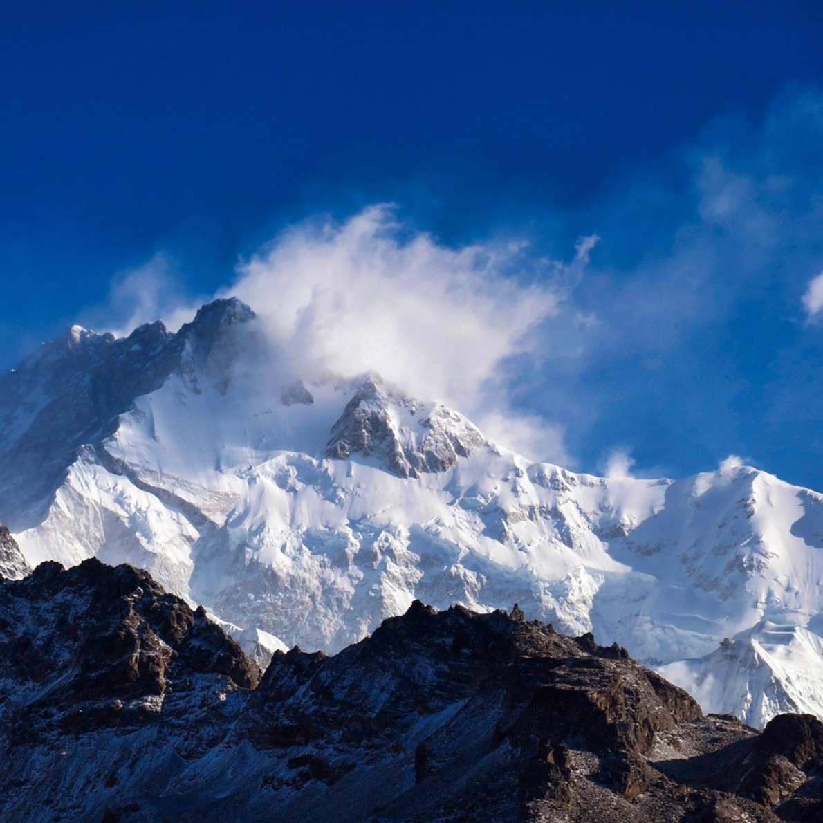
Mount Kanchenjunga (8,586m)
Mount Kanchenjunga dominates the skyline as the world’s third-highest peak and the second-highest in Nepal. The mountain contains five summits, known as the “Five Treasures of Snow,” four of which exceed 8,450 meters. Climbers respect a local religious prohibition that forbids standing on the actual summit, stopping a few meters short to honor the deity believed to reside there.
Mount Jannu (Kumbhakarna)
Mount Jannu (7,710m), locally called Kumbhakarna, rises abruptly from the ridges west of Kanchenjunga. Alpinists consider the north face of Jannu one of the most technically difficult climbs in the Himalayas due to its vertical rock walls and complex ice formations. The peak serves as a prominent landmark for trekkers on the South Base Camp route.
Kabru and Rathong
The Kabru massif extends south from Kanchenjunga, with Kabru North reaching 7,338 meters and Kabru South reaching 7,316 meters. Nearby, Rathong (6,678m) forms a critical junction on the border between Nepal and India. These peaks create a high-altitude amphitheater that surrounds the Yalung Glacier, feeding the major river systems downstream.
Key Villages in Kanchenjunga Region
Remote settlements in the Kanchenjunga region serve as cultural hubs and logistical waypoints for travelers.
Ghunsa (3,595m)
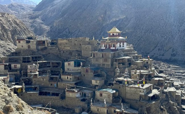
Ghunsa operates as the primary acclimatization stop for trekkers heading to the North Base Camp. This Sherpa village features lodges with electricity and internet access, making it the most developed settlement in the upper valley. Residents here practice Nyingmapa Buddhism and maintain ancient monasteries that date back centuries.
Olangchung Gola (3,191m)
Olangchung Gola, located near the Tibetan border, functions as a historical trade hub between Nepal and Tibet. The village hosts the Deki Chholing Gompa, a 450-year-old monastery that houses valuable Buddhist manuscripts and statues. The Walung people, descendants of Tibetan traders, inhabit this settlement and sustain their economy through yak herding and cross-border commerce.
Yamphudin (2,080m)
Yamphudin serves as the gateway to the Kanchenjunga South Base Camp for trekkers approaching from the lower hills. This mixed-ethnicity village contains Gurung, Rai, and Limbu households, offering visitors a diverse cultural experience. The village marks the transition from the mid-hills’ agricultural terraces to the high-altitude alpine zones.
Flora and Fauna in Kanchenjunga Region
The vertical gradient of the Kanchenjunga region supports 25 ecoregions, ranging from subtropical broadleaf forests to alpine tundra.
Protected Mammals
Snow leopards (Panthera uncia) roam the high-altitude rocky ridges above 4,000 meters, preying on blue sheep (bharal). The lower temperate forests harbor the endangered red panda (Ailurus fulgens), which relies on the dense bamboo undergrowth for survival. Researchers have also documented the presence of the Himalayan black bear and the clouded leopard in the mid-hills.
Avian Diversity
Ornithologists have recorded 252 bird species within the conservation area, including the spiny babbler and the golden-breasted tit-babbler. The blood pheasant, the state bird of Sikkim, thrives in the subalpine scrublands. Raptors such as the lammergeier and the golden eagle patrol the thermal currents near the high passes.
Botanical Riches
Botanists have identified over 2,000 flowering plant species in the region, 23 of which are endemic to Nepal. Rhododendrons dominate the landscape in spring, with more than 40 distinct species blooming across different altitudinal zones. Rare medicinal plants, including Yarsagumba (Ophiocordyceps sinensis) and Jatamansi, grow in the alpine meadows and support the local economy through regulated harvesting.
Kanchenjunga Conservation Area
The Kanchenjunga Conservation Area (KCA) protects 2,035 square kilometers of this unique ecosystem.
Establishment and Governance
The Government of Nepal established the KCA in March 1997 to preserve the region’s biodiversity and cultural heritage. In a landmark 2006 decision, the government handed over full management responsibility to the Kanchenjunga Conservation Area Management Council (KCAMC), making it the first community-managed conservation area in Asia. This decentralized model empowers seven Conservation Area User Committees to oversee forestry, wildlife protection, and tourism regulations.
Conservation Strategy
WWF Nepal collaborates with the KCAMC to implement anti-poaching patrols and snow leopard monitoring programs using camera traps. The management plan prioritizes the “Sacred Himalayan Landscape” initiative, which connects protected areas across Nepal, India, and Bhutan to maintain genetic corridors for migratory wildlife. Community-based insurance schemes compensate livestock owners for losses caused by snow leopards, reducing retaliatory killings and fostering coexistence.
Visitor Regulations
Visitors must obtain a Kanchenjunga Restricted Area Permit and a TIMS (Trekkers’ Information Management System) card to enter the region. Regulations mandate that all foreign trekkers hire a registered guide and travel in groups of at least two to ensure safety and compliance with environmental protocols. These measures help mitigate the impact of tourism on the fragile alpine ecosystem while generating sustainable income for local guides and porters.
Future Designation
The Kanchenjunga Conservation Area currently sits on the tentative list for UNESCO World Heritage Site recognition. This potential designation aims to further secure international support for the region’s conservation efforts and highlight its global significance as a biodiversity hotspot.