Comprehensive Information About Barun Valley
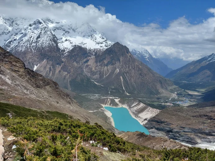
The Barun Valley is a high-altitude Himalayan valley located at the base of Mount Makalu in the Sankhuwasabha district of eastern Nepal. Geologists classify this valley as a pristine ecosystem preserved by its relative isolation and rugged terrain. The valley spans the transition zone between the subtropical Arun River valley and the alpine glacial zones of the Makalu-Barun National Park. Visitors access this area primarily through the Tumlingtar airport, followed by a multi-day trek that traverses the Shipton La pass.
Strict conservation policies protect the Barun Valley as a strict nature reserve, meaning no permanent human settlements exist within the core valley floor. This absence of habitation allows the ecosystem to flourish without the pressures of deforestation or agriculture that affect other Himalayan regions. Indigenous communities, primarily the Sherpa and Rai people, inhabit the periphery buffer zones and utilize the high pastures for seasonal yak herding during the monsoon months.
The climate varies drastically with elevation, shifting from humid subtropical conditions at 1,000 meters to arid alpine desert conditions above 4,000 meters. This vertical gradient supports a “biodiversity hotspot” where species from both the Indo-Malayan and Palearctic realms coexist. Trekkers entering the valley experience a complete ecological cross-section of the Himalayas within a span of 50 kilometers.
Trekking Trails in Barun Valley
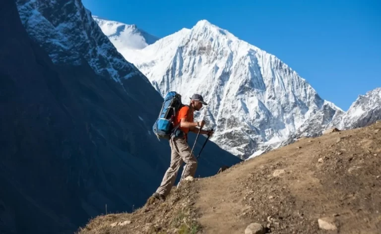
Hikers navigate the Barun Valley primarily through the Makalu Base Camp trek, a route that demands high physical endurance and self-sufficiency.
Makalu Base Camp Route
The Makalu Base Camp trail connects the humid lowlands of the Arun Valley to the glaciated high altitude of the Barun Glacier.
- Starting Point: Trekkers begin at Num (1,560m) or Chichila after a drive from Tumlingtar, descending steeply to the Arun River before climbing to Seduwa.
- Key Passes: The route crosses four significant passes in succession: Kauma La (3,603m), Tutu La (4,125m), Shipton La (4,170m), and Keke La (4,127m).
- Scenic Highlights: The trail offers unobstructed views of Makalu (8,485m), Chamlang (7,319m), and Baruntse (7,129m) from the Shipton La pass.
- Terrain Challenges: Hikers must navigate the unstable rockfall zones near the Nehe Kharka and the steep, slippery stone stairs leading to Mumbuk.
The Sherpani Col High Route
The Sherpani Col High Route connects the Barun Valley to the Khumbu (Everest) region via three high-altitude passes.
- Technical Difficulty: This expedition-style route requires mountaineering skills to cross Sherpani Col (6,180m), West Col (6,190m), and Amphu Labtsa (5,845m).
- Glacial Traverses: Teams traverse the upper Barun Glacier and the Hongu Glacier, requiring ropes, crampons, and ice axes for safe passage.
- Isolation: The section between Makalu Base Camp and Chhukung in the Everest region offers no teahouses or support, necessitating full camping logistics for 10 to 12 days.
Arun Valley Access
The Arun Valley trail provides a lower-altitude alternative that eventually joins the main Barun Valley route.
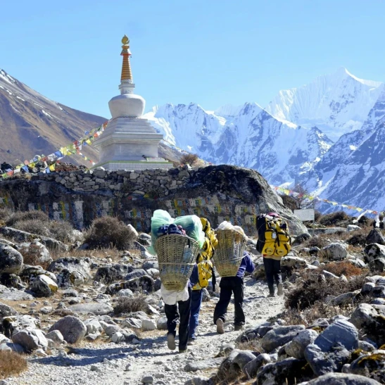
- Cultural Focus: Hikers walk through Rai and Limbu villages in the mid-hills, observing traditional agricultural practices before entering the uninhabited national park.
- Salpa La Connection: This route often incorporates the Salpa La pass (3,350m), a holy site for local shamans who perform rituals at the sacred Salpa Pokhari lake.
Major Mountains in Barun Valley
The Barun Valley sits cradled between the massive ridges of the Mahalangur Himal, hosting some of the world’s highest and most striking peaks.
Mount Makalu (8,485m)
Mount Makalu dominates the valley head as the world’s fifth-highest mountain.
- Distinct Shape: The peak forms a near-perfect four-sided pyramid, with sharp ridges separating its four distinct faces.
- Climbing History: A French expedition led by Jean Franco first summited Makalu in 1955, establishing the standard route via the north face and northeast ridge.
- Visual Dominance: Trekkers view the south face of Makalu directly from the Base Camp (4,870m), where the sheer rock wall rises over 3,500 meters above the glacier.
Mount Chamlang (7,319m)
Mount Chamlang stretches horizontally for over 10 kilometers, forming a massive barrier on the valley’s southern flank.
- Local Name: Locals refer to it as the “Bird with Flapping Wings” due to its long, flat summit ridge that extends east to west.
- Strategic Location: The mountain separates the Barun Valley from the Hongu Valley to the west, blocking moisture and influencing the local microclimate.
- Expedition Challenge: Alpinists consider the traverse of the entire Chamlang ridge one of the great unclimbed challenges in modern Himalayan mountaineering.
Mount Baruntse (7,129m)
Mount Baruntse stands at the head of the Hinku Glacier, flanked by the Barun Glacier to the east.
- Symmetry: The mountain features a symmetrical snow cone shape, bounded by four distinct ridges that offer classic steep ice climbs.
- Training Peak: Expedition leaders often use Baruntse as a training ground for climbers preparing for 8,000-meter peaks like Everest or Lhotse.
- Visibility: Hikers can spot Baruntse clearly from the Mera Peak summit and the high passes leading out of the Barun Valley.
Mera Peak (6,476m)
Mera Peak rises on the edge of the Barun and Hinku valleys, serving as Nepal’s highest “trekking peak”.
- Accessibility: Climbers with basic mountaineering skills can summit Mera Peak, making it a popular objective for commercial expeditions.
- Panorama: The summit offers a view of five 8,000-meter peaks: Everest, Lhotse, Cho Oyu, Makalu, and Kanchenjunga.
Key Villages in Barun Valley
Permanent settlements exist only in the lower buffer zones of the Makalu-Barun National Park, as the upper valley remains a protected wilderness.
Seduwa (1,500m)
Seduwa serves as the official entry point to the Makalu-Barun National Park where rangers check permits.
- Community Profile: The village consists primarily of Rai and Sherpa households engaged in subsistence farming of cardamom, corn, and millet.
- Educational Hub: Seduwa hosts a secondary school that serves students from remote surrounding hamlets, acting as a center for local education.
- Infrastructure: Trekkers find basic lodges and shops here to restock supplies before the long ascent to the high passes.
Tashigaon (2,100m)
Tashigaon stands as the last permanent settlement on the trail to Makalu Base Camp.
- Sherpa Culture: The residents maintain strong Sherpa traditions, evident in the prayer flags fluttering over slate-roofed houses and the small gompa near the village center.
- Logistics Checkpoint: Expeditions hire local porters here for the high-altitude section, as low-altitude porters often turn back due to the cold and lack of shelter ahead.
- Camping Transition: Beyond Tashigaon, accommodation shifts to seasonal stone huts (kharkas) and tented camps, marking the end of village-based trekking.
Num (1,560m)
Num sits on a ridge overlooking the Arun River, functioning as the roadhead for most modern treks.
- Transport Link: Jeeps from Tumlingtar terminate here, connecting the remote valley to the rest of Nepal’s road network.
- Market Town: The weekly market in Num attracts traders from the upper hills who exchange mountain herbs and wool for rice, salt, and manufactured goods.
- Geography: The village offers a direct view of Seduwa on the opposite ridge, though reaching it requires a steep descent of 800 meters and an equal ascent.
Khongma Danda (3,500m)
Khongma Danda operates as a seasonal settlement composed of lodges built specifically for trekkers.
- Acclimatization Stop: Guides mandate a rest day here to allow hikers’ bodies to adjust to the altitude before crossing the Shipton La pass.
- Location: The settlement perches on a narrow ridge, often shrouded in mist and snow, providing a stark contrast to the lush forests below.
Flora and Fauna in Barun Valley
The Barun Valley protects one of the last remaining pristine forest ecosystems in the eastern Himalayas.
Rare Mammals
The dense forests and alpine meadows support a diverse range of elusive mammals.
- Red Panda (Ailurus fulgens): The temperate bamboo forests between 2,500 and 4,000 meters host a significant population of endangered red pandas.
- Clouded Leopard (Neofelis nebulosa): Researchers have documented clouded leopards in the subtropical forests of the lower Barun valley, a rare sighting for this altitude.
- Himalayan Black Bear (Ursus thibetanus): Black bears frequent the oak and rhododendron forests, often descending near villages during corn harvest season.
- Snow Leopard (Panthera uncia): The rocky crags above 4,500 meters serve as hunting grounds for snow leopards, which prey on blue sheep and marmots.
Avian Diversity
Ornithologists have recorded 440 bird species in the Makalu-Barun National Park.
- Spiny Babbler (Turdoides nipalensis): The park shelters the spiny babbler, Nepal’s only endemic bird species, in the lower scrublands.
- Blyth’s Tragopan: This vibrant pheasant species inhabits the dense undergrowth of the rhododendron forests.
- Raptors: High-altitude ridges provide thermal lifts for bearded vultures (lammergeiers) and Himalayan griffons.
Botanical Riches
The valley exhibits a complete bioclimatic zonation of vegetation.
- Rhododendrons: The region boasts 25 of Nepal’s 30 rhododendron species, which bloom in vibrant reds, pinks, and whites during the spring.
- Medicinal Plants: The alpine meadows (kharkas) abound with aromatic herbs like Swertia chirayita and Cordyceps sinensis (Yarsagumba), which locals harvest sustainably.
- Orchids: The humid lower forests support 47 varieties of orchids, many of which cling to the mossy trunks of ancient trees.
- Primulas: Rare primula species carpet the high passes in purple and yellow flowers immediately after the snow melts.