Government-licensed trekking agency

Travel To Nepal

2027/2028 season open · start on any date you choose

Annapurna Circuit Trek 13 Days (Itinerary, Cost, Complete Guide)

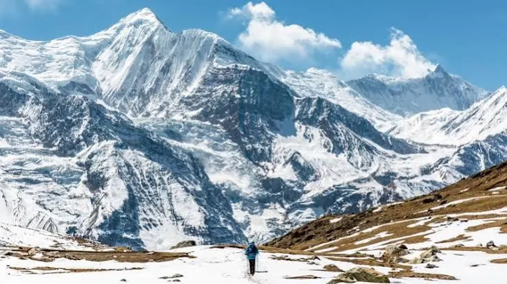
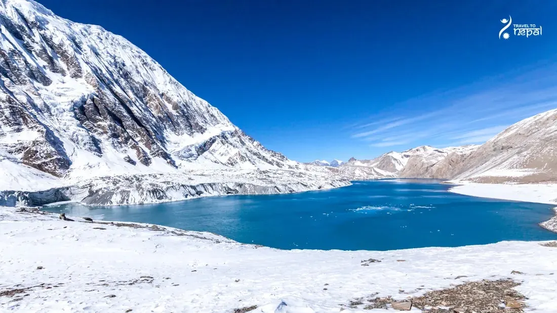
Tilicho Lake, Annapurna Circuit Trek
  • Thorong La 5,416 m
  • Acclimatisation day
  • Local guide-led

Introduction

The Annapurna Circuit Trek is a long teahouse trek around the Annapurna range in central Nepal. It follows the Marsyangdi valley on the east side and the Kali Gandaki valley on the west side. Thorong La Pass (5,416 m / 17,769 ft), the highest point of the trek, joins the two valleys. The whole route lies inside the Annapurna Conservation Area, Nepal's largest protected area.

Trip overview and key sections.

Verified route 2027/2028

  • Start / finish
    Kathmandu / Kathmandu
  • Total distance
    ~100 km / 62 miles
  • Daily walking
    5 to 7 hours a day (8–10 on the pass)
  • Regions
    Annapurna Region → Mustang Region
  • Country
    Nepal
  • Duration
    13 days
  • Difficulty
    Challenging
  • Max. altitude
    5,416 m / 17,769 ft
  • Best season
    Mar–May, Oct–Nov
  • Accommodation
    Teahouse and hotel
  • Transport
    Bus, Jeep, Flight (Optional)
  • Activity
    Trekking / hiking

Do you have any specific questions that you want to ask us personally?

Message us on WhatsApp or send us an email. Either I or my team will personally answer your questions and make sure all your doubts are answered properly.

  • Prompt 1-to-1 local advice
  • Free itinerary discussion
  • Fast reply on WhatsApp

Trek milestones

Annapurna Circuit Trek highlights and why you will love this trek

  • Crossing Thorong La (5,416 m / 17,769 ft)

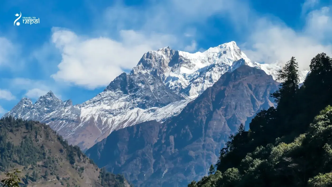
    Stand at the highest point of the trek, among prayer flags, with Thorong Peak, Yakawa Kang and Khatung Kang around you.

  • Reach Tilicho Lake (4,919 m)

    See a deep turquoise lake under the ice walls of Tilicho Peak (7,134 m), far from the main trail.

  • Walk among the world's highest mountains

    Trek in view of three of the world's ten highest peaks, Dhaulagiri I (8,167 m), Manaslu (8,163 m) and Annapurna I (8,091 m), plus more than ten peaks above 7,000 m, such as Annapurna II, Gangapurna and Tilicho Peak.

  • Spend time in Manang

    Rest in the largest village of the upper valley, with bakeries, old monasteries and a free daily altitude talk at the Himalayan Rescue Association aid post.

  • Visit Muktinath Temple

    See the 108 water spouts and the natural flame that make this temple sacred to both Hindus and Buddhists.

  • See many cultures in one trek

    Meet Gurung farmers in the lower valley, Manangi people of Tibetan origin in upper Manang, and Thakali families in the Kali Gandaki.

Trekker suitability guide

Is this trek for you?

An honest checklist from our guides to help you decide if the Annapurna Circuit suits your fitness and preference.

Suitability checklist

  • Accommodation: Family-run teahouses every night. Lodges in Chame, Upper Pisang, Manang and Muktinath are good. Rooms at Tilicho Base Camp, Yak Kharka and Thorong Phedi are very basic.

  • Bathrooms: Some lodges have attached bathrooms up to Manang and again in Muktinath. Above Manang, at Tilicho Base Camp, Shree Kharka, Yak Kharka and Thorong Phedi, expect shared toilets only.

  • Food: Dal bhat, noodles, soups, potatoes, eggs and Tibetan bread everywhere. Manang has bakeries, pizza, pasta and real coffee. Menus get shorter and prices get higher above Manang.

  • Difficulty: Challenging. No climbing skills are needed, but you walk at high altitude for many days, cross a narrow landslide zone on the way to Tilicho, and climb to 5,416 m on Thorong La.

  • Daily Walking: 4 to 7 hours on most days. The Thorong La day takes about 9 hours.

  • Duration: 13 days from Kathmandu to Kathmandu, including 2 jeep days, 1 drive day and 1 acclimatization day in Manang.

  • Trail Conditions: Good, wide trails up to Manang. Narrow and loose on the Tilicho landslide zone and before Thorong Phedi. Steep and rocky on both sides of Thorong La. Snow and ice are possible on the pass in any season.

  • Roads: Jeep roads now reach Chame on the east side and Muktinath on the west side. The jeep days are long and bumpy, and landslides can slow them down.

  • Crowds: Busy in October, November, March and April, when lodges at Thorong Phedi and High Camp fill up. Much quieter from December to February and in the monsoon.

Unsure about your fitness or readiness?Our lead trek director gives a free, no-obligation preparation check.

Step-by-step route

13-day day-by-day itinerary

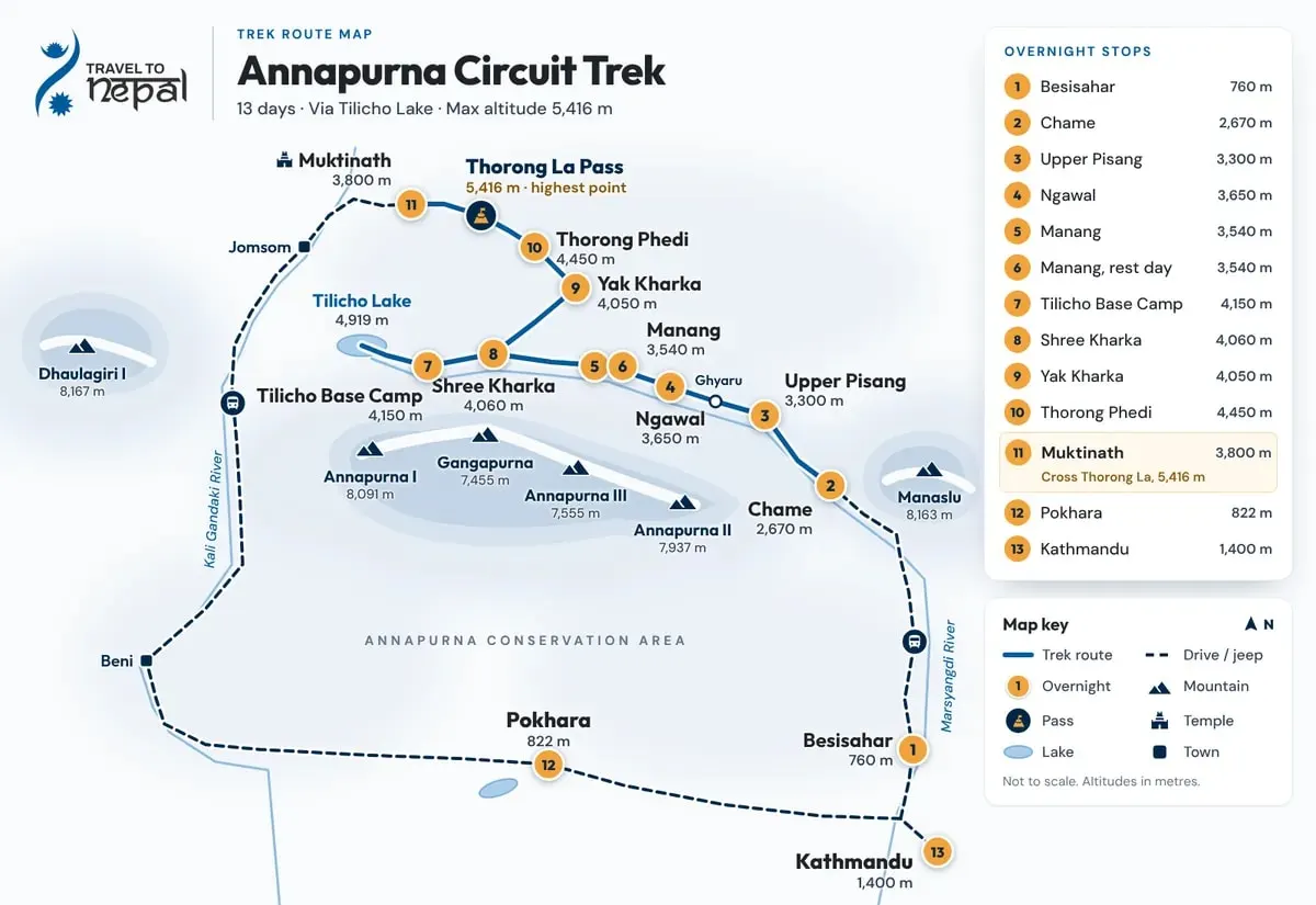
This 13-day Annapurna Circuit itinerary with Tilicho Lake suits most fit trekkers. The plan follows a safe acclimatization pattern. Above 3,000 m, you never sleep more than about 630 m higher than the night before, and the biggest jump, to Tilicho Base Camp, comes right after a rest day in Manang. You also sleep three nights above 4,000 m before you reach Thorong Phedi, the last stop below the pass.

Annapurna Circuit Trek Overview Map
  1. Day 1: Drive from Kathmandu to Besisahar

    Scenic drive along the Trishuli and Marsyangdi rivers.

    About 7 Hours · 760 m

    The trip starts with a 7 hour drive west from Kathmandu to Besisahar, the headquarters of Lamjung district. We leave early in the morning to avoid city traffic. The road follows the Prithvi Highway beside the Trishuli River to Mugling. Here, the Trishuli meets the Marsyangdi River, and this river stays with you all the way to Manang. At Dumre, the road turns north off the highway and follows the Marsyangdi up to Besisahar.

    Today is a travel day, so there is no walking. The views are of green hills, terraced rice fields and river valleys. On clear days, you may see Manaslu (8,163 m) and Lamjung Himal (6,983 m) to the north as you get close to Besisahar.

    Besisahar is a busy road town at 760 m, with many hotels, shops and banks. It is the last place on the east side with reliable ATMs, so take out any extra cash you need here. Your guide will go over the plan for tomorrow's jeep ride.

    Hotels in Besisahar are modern, with attached bathrooms, hot showers, Wi-Fi and full Nepali, Indian and Western menus. This is the most comfortable night of the trek until Pokhara, so enjoy a hot shower and a good sleep.
  2. Day 2: Drive from Besisahar to Chame by Jeep

    Bumpy jeep ride through the gorge to Chame.

    About 5 to 6 hours · 2,670 m

    Today you ride a jeep up the Marsyangdi valley from Besisahar to Chame, the headquarters of Manang district. The road is paved for only a few kilometers. After that, it is a narrow, rough dirt road cut into the side of the gorge. The jeep passes Ngadi, Jagat, Tal, Dharapani and Koto before reaching Chame. Expect a bumpy ride, slow sections and short stops to let other jeeps pass.

    This is one of the most scenic drives in Nepal. Waterfalls pour down the cliffs near Chamje. At Tal, you enter Manang district, and the valley opens into a wide, flat area beside the river. At Dharapani, the Manaslu Circuit trail joins the road, and there is an ACAP checkpoint where your guide shows your permit. On clear days, Himalchuli (7,893 m) and Ngadi Chuli (7,871 m) are visible in the lower valley, and Annapurna II (7,937 m) appears above Chame.

    Landslides are the main risk on this road, especially in the monsoon and after autumn storms. In late September 2026, landslides blocked the road for six days before it reopened on 3 October. Your guide checks the road each morning and will tell you if we need to walk a short section or wait for the road to clear.

    Chame sits at 2,670 m beside the Marsyangdi, with around 20 lodges. Rooms are simple but good, and some have attached bathrooms. A small hot spring lies by the river. Evenings here are much colder than in Besisahar, so put on a warm layer after sunset.

  3. Day 3: Trek from Chame to Upper Pisang

    Forest and orchard walk to Upper Pisang.

    5 to 6 hours · 3,300 m

    Today is your first full walking day. The trail follows the Marsyangdi River west through pine and fir forest. After about 2 hours, you reach Bhratang (2,850 m), a small settlement known for its large apple orchard. Buy a few fresh apples or a glass of apple juice here.

    After Bhratang, the valley gets narrow. The trail passes a famous section where the road is cut into the cliff face. Across the river, you see Paungda Danda, a huge curved slab of smooth rock that rises high above the river. Local people call it Swarga Dwari, which means "Gate to Heaven".

    The trail then crosses the river and climbs gently to Dhukur Pokhari (3,240 m), a good lunch stop with a small pond. From here, the valley opens wide, and the forest gets thinner. A short, steep climb of about an hour brings you to Upper Pisang. Walk slowly on this last part, because you are now above 3,000 m.

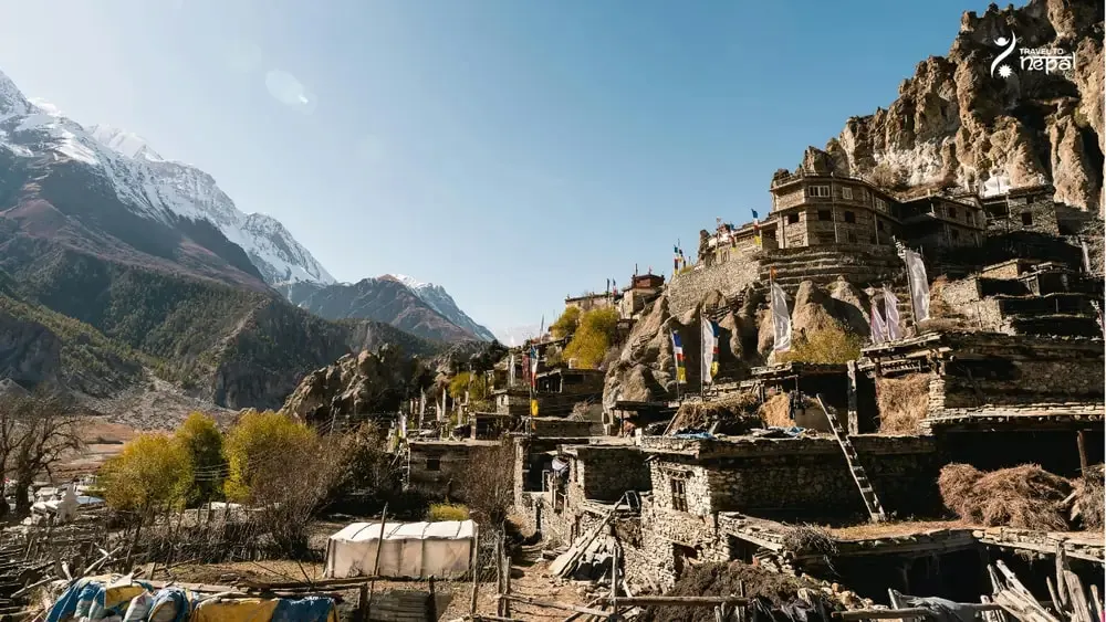
    Upper Pisang is an old Tibetan Buddhist village of stone houses built on a hillside. From the village, you get a direct view of Annapurna II (7,937 m) across the valley, plus Annapurna IV (7,525 m) and Pisang Peak (6,091 m). Visit the gompa above the village in the late afternoon. Lodges here are good, and some rooms have attached bathrooms, but the rooms are colder than in Chame.

  4. Day 4: Trek from Upper Pisang to Ngawal via Ghyaru

    Steep climb to Ghyaru, high trail to Ngawal.

    4 to 5 hours · up to 3,730 m at Ghyaru · sleep 3,650 m

    Today you take the upper trail to Manang, which many trekkers say is the most beautiful section of the whole circuit. There are two ways from Pisang to Manang. The lower route follows the valley floor and the road. The upper route climbs to the villages of Ghyaru and Ngawal on the north side of the valley. It has no road, fewer people and much better views, and the extra height also helps your acclimatization.

    The day starts with the hardest part. From Upper Pisang, the trail drops to the river and then climbs a steep zigzag path for about 400 m to Ghyaru (about 3,730 m). This climb takes 1.5 to 2 hours. Go slowly, take short steps and stop to breathe when you need to. The view from Ghyaru is the reward: Annapurna II, Annapurna III and Annapurna IV stand right across the valley, and you can see far down the Marsyangdi.

    After Ghyaru, the trail is almost flat. It follows the hillside for about 5 km past mani walls, chortens and old ruins, at about 3,700 m. Pisang Peak rises behind you, and the Chulu peaks appear ahead. This part takes about 2 hours and is easy walking.

    Ngawal (3,650 m) is a quiet Manangi village with a gompa, prayer wheels and stone houses. Several lodges and small cafes serve trekkers, and some rooms have attached bathrooms with mountain views. Phone signal here is weak, so this is a good evening to rest and enjoy the view of the Annapurnas turning pink at sunset.

  5. Day 5: Trek from Ngawal to Manang

    Easy valley walk through Braga to Manang.

    About 4 hours · 3,540 m

    Today is a short and easy day. From Ngawal, the trail drops steadily for about an hour to Humde (3,330 m), a village with a small airstrip. Here, you join the main Annapurna Circuit trail on the valley floor.

    From Humde, a wide, nearly flat path runs about 6 km west to Braga (3,450 m). This part takes about 2.5 hours. Annapurna III (7,555 m) and Gangapurna (7,455 m) rise on your left the whole way, and you pass long mani walls and chortens. Braga is a village of stone houses stacked on a hillside, with an old monastery above it. If you have energy, climb up to see the monastery's statues and paintings.

    From Braga, a flat 30-minute walk brings you to Manang (3,540 m) by lunchtime. Manang is the largest village in the upper valley, with more than 30 lodges, bakeries selling apple pie and cinnamon rolls, coffee shops, a small cinema and shops selling snacks and warm gear. Manang also has an ATM, but it often does not work, so do not depend on it.

    In the afternoon, visit the Himalayan Rescue Association (HRA) aid post. In spring and autumn, it runs a free talk on altitude sickness at 3 PM every day. The talk explains how to spot altitude sickness and what to do about it. It is the best hour you can spend before the high part of the trek.

  6. Day 6: Acclimatization Day in Manang (Hike to Ice Lake)

    Rest day and Ice Lake acclimatization hike.

    6 to 8 hours · up to 4,600 m at Ice Lake · sleep 3,540 m

    Today you rest in Manang, but "rest" does not mean staying in bed. The best way to adjust to altitude is to climb high during the day and sleep low at night. So you take a day hike above Manang and come back to the same lodge to sleep. This day is very important. It prepares your body for Tilicho Base Camp tomorrow and for Thorong La five days later.

    Ice Lake (Kicho Tal, 4,600 m) is the main hike, and the most demanding one. The trail starts behind Braga and climbs steeply and steadily for about 1,060 m. It takes 6 to 8 hours to go up and come back. A small seasonal tea stall sits about halfway up, at around 4,200 m. There is no food or water at the lake, so carry a packed lunch, snacks and at least 2 liters of water. The lake can stay frozen until late April. From the top, you see Annapurna II, III and IV, Gangapurna and Tilicho Peak.

    If you feel tired, or if the weather is bad, your guide will suggest an easier hike:

    • Chongkor Viewpoint (3,900 m): 1 to 2 hours, easy to moderate. Views of Annapurna II to IV, Gangapurna, Tilicho Peak, the Chulu peaks and Pisang Peak.

    • Praken Gompa (3,945 m): About 2 hours uphill each way. A small monastery in the cliffs where a resident lama gives blessings to trekkers.

    • Gangapurna Lake: A short walk from Manang. Floods in 2021 filled the lake with silt and it lost most of its water, so the Chongkor Viewpoint above it now gives a better view of the Gangapurna Glacier.

    • Milarepa Cave (about 4,100 m): About 2 hours each way from Braga, steep. A cave linked to the Tibetan saint Milarepa, below Annapurna III.

    After the hike, eat a big dinner and drink plenty of fluids. Your guide will check your oxygen level and ask how you feel. Tell them about any headache, poor appetite or poor sleep.

  7. Day 7: Trek from Manang to Tilicho Base Camp

    Past Khangsar and a landslide zone to Tilicho.

    About 7 hours · 4,150 m

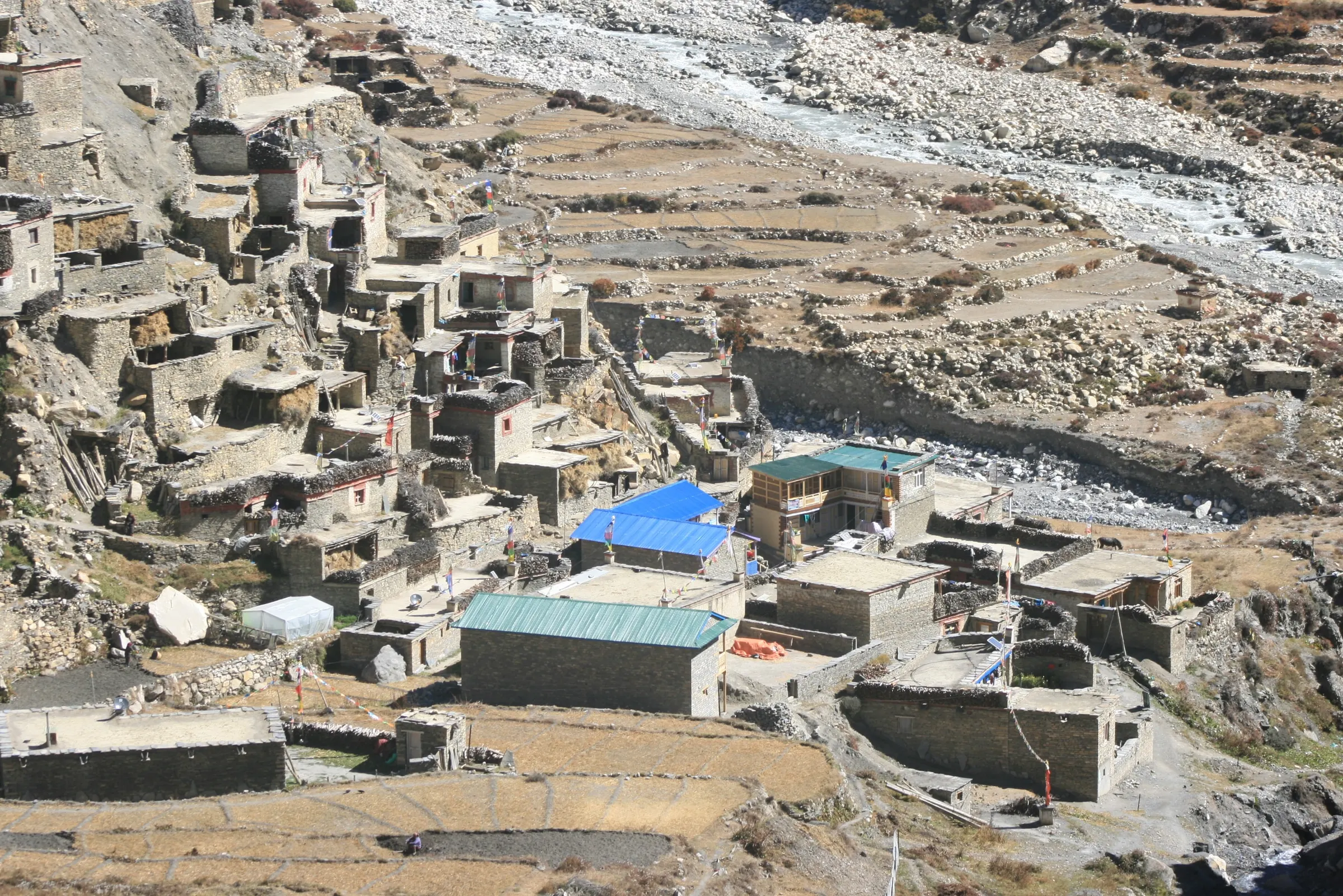
    Today you leave the main Annapurna Circuit and walk west toward Tilicho Lake. From Manang, the trail crosses the Marsyangdi and climbs gradually for about 2 hours and 5 km to Khangsar (3,734 m). Khangsar is a quiet village of flat-roofed stone houses and stacked firewood. Few trekkers stop here, so it feels calm compared to Manang.

    From Khangsar, the trail climbs steeply at first and then more gently for about 2.5 hours to Shree Kharka (4,060 m), where you stop for lunch. Khangsar Kang (7,485 m), also called Roc Noir, towers over the valley ahead.

    The last 5 km from Shree Kharka to Tilicho Base Camp is the most dangerous part of the whole trek. The trail crosses a long, steep slope of loose scree, and small rocks sometimes fall from above. The path is narrow, with a big drop below. Follow your guide's rules here: walk steadily, do not stop for photos, keep a gap between you and the person in front, and look up the slope from time to time. This section takes about 2.5 hours.

    Tilicho Base Camp (4,150 m) has about 10 lodges, a health post and grid electricity since 2024. Rooms are basic wooden rooms or dorms with no heating, and toilets are shared. The lodges fill up fast in October, which is why we book ahead. Nepal Telecom phone signal has worked here since October 2025. Eat an early dinner and go to bed early, because tomorrow starts around 5 AM.

  8. Day 8: Hike to Tilicho Lake (4,919 m), then Trek to Shree Kharka

    Early climb to Tilicho Lake, then Shree Kharka.

    About 7 hours · up to 4,919 m at Tilicho Lake · sleep 4,060 m

    Today you climb to Tilicho Lake, the highlight of the side trip. You leave base camp at about 5 AM. The trail to the lake is 5 km long, but it climbs about 800 m on a steep zigzag path up a dusty slope. It takes about 3.5 hours. Walk slowly and breathe deeply. In late autumn and spring, there may be snow and ice near the top, so your guide may ask you to wear microspikes.

    At the top of the climb, the trail reaches a ridge, and Tilicho Lake (4,919 m) appears in front of you. The lake is deep turquoise in autumn and is often frozen from December to March. Tilicho Peak (7,134 m) rises above the far shore, with glaciers dropping toward the water. Spend about 30 minutes here for photos and a snack. The wind at the lake is cold even on sunny days, so keep your down jacket on.

    The walk back down to base camp takes about 1.5 hours on the same steep path. Use your trekking poles and take short steps. You have lunch at base camp. Then you cross the landslide zone again and walk 2 hours back to Shree Kharka (4,060 m). The same safety rules apply: keep moving and do not stop in the exposed section.

    Sleeping at Shree Kharka, about 90 m lower than base camp, helps your body recover after the high climb. You reach it by mid-afternoon. Lodges here are simple, with shared toilets and short menus.

  9. Day 9: Trek from Shree Kharka to Yak Kharka

    Rejoin the main trail at Yak Kharka.

    About 7 hours · 4,050 m

    Today you walk back to the main Annapurna Circuit trail without going back to Manang. The first 5 km is a gentle 2-hour descent from Shree Kharka to Khangsar. From Khangsar, you take a side trail that drops to the river, crosses it and climbs the slope on the other side. This part has some steep climbs, so take regular water breaks.

    The trail joins the main circuit above Manang and continues up the wide, open valley to Yak Kharka. This section from Khangsar takes about 5 hours and 8 km. Gangapurna and Annapurna III stay behind you, and the Chulu peaks rise to the east. Look out for blue sheep on the slopes in the late afternoon.

    Yak Kharka (4,050 m) means "yak pasture", and the village sits on wide grassy slopes used by herders. Rooms are small and basic, with thin walls and shared toilets, and electricity can be weak. Your sleeping height is almost the same as last night, which keeps your acclimatization steady before the last climb.

  10. Day 10: Trek from Yak Kharka to Thorong Phedi

    Short walk to Thorong Phedi, then rest.

    About 4 hours · 4,450 m

    Today is short on purpose, so you can rest before Thorong La. From Yak Kharka, the trail climbs gently for about an hour and 2 km to Ledar (4,200 m), a small group of lodges and the last settlement before Thorong Phedi.

    After Ledar, the trail crosses a suspension bridge and climbs along the valley side for about 3 hours. The last part runs across a narrow, landslide-prone slope above the river. Loose stones can fall from above, so walk steadily through this section and do not stop.

    Thorong Phedi (4,450 m) is the last stop below the pass. "Phedi" means "foot of the hill" in Nepali. Yakawa Kang (6,482 m) and Khatung Kang (6,484 m), the two mountains on either side of the pass, rise above you. There are only 2 to 3 lodges here, and rooms are very basic: dorms or small twin rooms, little or no heating, shared toilets and limited hot water. Some lodges offer paid Starlink Wi-Fi, but there is no phone signal.

    Spend the afternoon resting, eating well and drinking plenty of water. A short walk up the slope above the lodge and back helps your body adjust. Pack your bag tonight and put your warm clothes, gloves, headlamp and snacks on top. Tomorrow starts at about 3 AM.

    Some groups sleep at Thorong High Camp (4,880 m) instead, one hour above Phedi. This makes tomorrow shorter, but you sleep 430 m higher, in colder and windier rooms. We sleep at Thorong Phedi because a lower night is safer for most trekkers.

  11. Day 11: Cross Thorong La Pass (5,416 m) and Trek to Muktinath

    Cross Thorong La at dawn, descend to Muktinath.

    About 9 hours · up to 5,416 m at Thorong La · sleep 3,800 m · High point

    Today is the biggest day of the trek. You climb about 1,000 m to Thorong La and then descend about 1,650 m to Muktinath. You wake up around 3 AM, eat a quick breakfast and start walking at about 4 AM. Strong winds usually build on the pass by late morning, so an early start gives you calmer, safer conditions.

    The first part is the steepest. The trail climbs about 430 m in just 1.2 km to Thorong High Camp (4,880 m), which takes about an hour in the dark. Keep your headlamp on and walk slowly. From High Camp, the trail climbs 4 km to the pass in about 3.5 hours. The slope is gentler, but every step feels heavy in the thin air. You will see several false summits, where the trail seems to end but keeps going. Keep a steady pace, eat a snack every hour and drink water even if you are not thirsty.

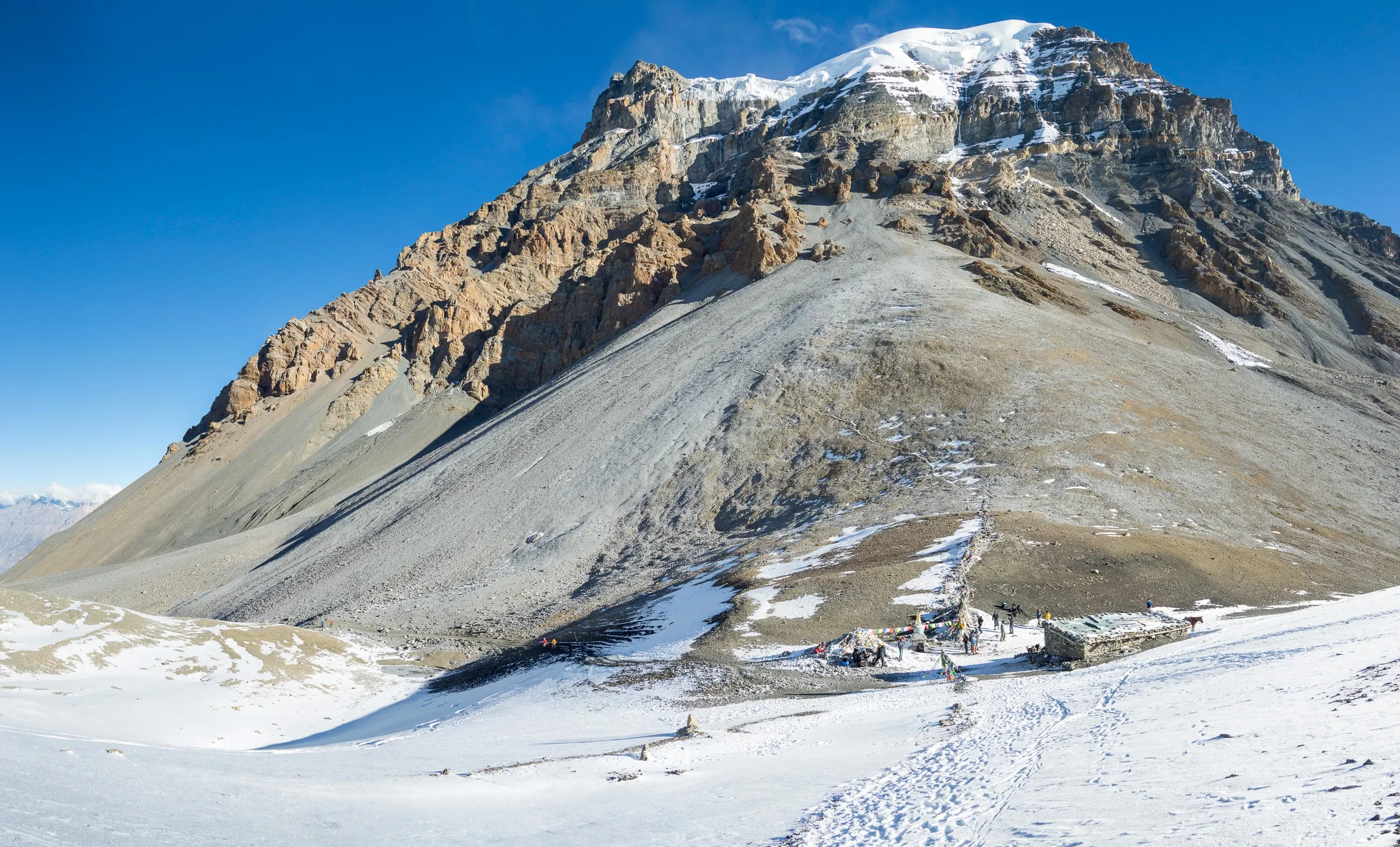
    You reach Thorong La (5,416 m) at around 8 to 9 AM. Prayer flags, a large sign and a chorten mark the top. Thorong Peak (6,144 m) rises beside you. In peak season, a small tea shop sometimes runs near the top, but do not count on it. Take your photos, but do not stay longer than 20 to 30 minutes, because your body cools down fast at this height.

    The descent is long and steep. The first 7.5 km drops about 1,230 m on loose gravel to Chabarbu (4,190 m), also called Muktinath Phedi. Use your trekking poles and take short steps to protect your knees. As you come down, Dhaulagiri I (8,167 m) and Tukuche Peak (6,920 m) appear across the Kali Gandaki valley. From Chabarbu, a gentle 1-hour walk on grassy slopes takes you to Muktinath (3,800 m).

    If anyone shows signs of serious altitude sickness on the climb, such as confusion, loss of balance or a bad headache that does not go away, your guide will turn them back to Phedi. Your safety comes before the pass.

    You stay in Ranipauwa, the village just below Muktinath Temple. Lodges here are comfortable, with attached bathrooms, hot showers and reliable electricity. In the late afternoon, if you still have energy, visit the temple (about 3,710 m). Pilgrims bathe under its 108 stone water spouts, and inside the Jwala Mai shrine a small natural flame burns beside a spring. Remove your shoes where signs ask, and behave quietly.

  12. Day 12: Drive from Muktinath to Pokhara

    Long drive down the Kali Gandaki to Pokhara.

    About 7 hours · 822 m

    Today you drive from the high desert of Mustang down to Pokhara. The first hour takes you 23 km from Muktinath past Jharkot and Kagbeni to Jomsom (2,720 m), the headquarters of Mustang district. Kagbeni is an old mud-brick village with a red monastery, and it is the gateway to the restricted Upper Mustang region.

    From Jomsom, the road follows the Kali Gandaki River south through one of the deepest gorges in the world. You pass Marpha (2,670 m), a whitewashed Thakali village famous for apples, apple brandy and cider. Nilgiri North (7,061 m) and Tukuche Peak rise above the valley, and near Lete you can see Annapurna I on clear days. The 55 km from Jomsom to Tatopani (1,190 m) takes about 2.5 hours on a rough road. Then 25 km more brings you to Beni (830 m), where the paved road starts. The last 80 km to Pokhara takes about 2.5 hours.

    The land changes fast on this drive. Dry, brown hills give way to pine forest, then to green terraced fields and banana trees. The Kali Gandaki road is rough and dusty, and it can be slowed by landslides. Autumn 2026 storms damaged the Beni to Jomsom road in many places, so plan for a long day.

    You can also drive 1 hour to Jomsom and fly 20 to 25 minutes to Pokhara. Strong winds after late morning often cancel these flights. Also, Tara Air and Summit Air suspended regular Jomsom to Pokhara flights from 19 to 21 October 2026, reportedly for about five months, so only charter flights may be available. Ask us about the current situation before you book.

    Pokhara sits beside Phewa Lake at 822 m. After almost two weeks in the mountains, you can enjoy a hot shower, a full menu and a walk along Lakeside.

  13. Day 13: Drive from Pokhara to Kathmandu

    Drive or fly from Pokhara to Kathmandu.

    About 7 hours · 1,400 m

    On the last day, you drive back to Kathmandu on the Prithvi Highway. On clear mornings, look north before you leave Pokhara for views of Machhapuchhre (6,993 m) and Annapurna South (7,219 m).

    The road heads east past Damauli to Mugling, where you meet the Trishuli River again, then follows the Trishuli toward Kathmandu. The bus stops for lunch and tea breaks at highway restaurants. You reach Kathmandu in the afternoon, but traffic at the valley entrance can add an hour or more.

    If you want to save time, you can fly from Pokhara to Kathmandu in about 25 minutes. The flight is not included in the package, but we can book it for you.

Unlimited free changes until it is right

Custom itinerary and private changes

Want to match your own pace, fitness, group or holiday dates? Tell us what you have in mind and our Kathmandu team will change the route as many times as you need, until it is the Annapurna Circuit you want.

  • Extra rest day
  • Add a side trip
  • Private guide and porter
  • Slower or faster pace

WhatsApp +977 9847693070 · inquiry@traveltonepal.com · Reply usually within a few hours

Full disclosure

Inclusion and Exclusion in Annapurna Circuit 13 Days package

Included in the price

  • Ground transport: Kathmandu to Besisahar by local tourist bus, local jeep to Chame, Muktinath to Pokhara to Kathmandu by tourist bus.

  • Government Licensed Trek guide: English speaking, first-aid trained, insured and fairly paid.

  • Lodging: Quality Teahouses during the trek

  • Permits: Annapurna Conservation Area Permit (ACAP)

  • Safety gear and transfers: pulse oximeter, first-aid kit, and airport transfers in Kathmandu.

  • Accessories: Trekking Map, Sun Hat, Duffel Bag (if porter)

  • Medicial Supplies: Our guides carry a first aid kit but, under Nepalese law, are not permitted to administer medication directly to clients.

  • Dessert: Fresh fruit during the trek

  • Certificate: Trip Completion Certificate

  • Government Taxes: All taxes for the trip

Not included

  • Meals on the trek: order freely from the menu (about USD 25 to 35 a day).

  • International airfare: flights to and from Kathmandu.

  • Porter (optional): include porter at USD 250 per porter (1 porter carries for 2 person bag. Weight limit: 20 kg)

  • Domestic flight: Jomsom to Pokhara to Kathmandu flight

  • Travel insurance: required, with helicopter rescue cover up to 6,000 m.

  • Nepal tourist visa: on arrival at the airport.

  • Personal Expenses: hot showers, battery charging and Wi-Fi.

Why don't we include meals in our trekking package?

Trekker-first transparency

  • Freedom of choice and appetiteAppetite changes with altitude. Order what your body wants, from dal bhat to pasta, porridge or soup.

  • Direct support for teahouse familiesYou pay the lodges directly, so all food money stays with the local families who run them.

  • No package markupsAll-inclusive meal packages are often padded. Here you pay real menu prices for what you eat.

  • Dietary needs and allergiesVegetarian, vegan or gluten-free: order on the spot and get food made the way you need it.

Average daily food budget: plan on about $22–30 USD per day for hearty breakfasts, lunches, hot dinners and boiled drinking water or tea.

Pro tips and important notes

Trail pro tips

  • Leave Thorong Phedi by 4:00 AM: Start the Thorong La climb between 4 and 5 AM. The climb from Thorong Phedi (4,450 m) to the pass takes 4 to 6.5 hours, and strong winds usually build on the pass by late morning. Late starters reach the top in cold, gusty wind and face the long descent when they are already tired. Carry a headlamp

  • Reserve Your Trek Early: Book 1 to 2 months ahead for October, November, March and April. Thorong Phedi has only 2 to 3 lodges, High Camp has 1 to 2, and Tilicho Base Camp fills up fast in October. Trekkers who arrive without a booking sometimes sleep in the dining hall.

  • Take the Acclimatization Day in Manang Seriously: Use your rest day in Manang to climb high and sleep low. Hike to Ice Lake or at least to Chongkor Viewpoint, then come back to Manang to sleep. Trekkers who skip this day face a much higher risk of altitude sickness on Tilicho and Thorong La.

  • Cross the Tilicho Landslide Zone Quickly: Walk the scree section between Shree Kharka and Tilicho Base Camp in the morning, keep moving and do not stop for photos. Small rocks can fall from above. Keep a gap of a few meters between you and the trekker ahead, and look up the slope from time to time.

  • Avoid Meat Above Manang: Skip meat once you leave Manang. Meat is carried up without a fridge and can be several days old. A stomach upset at Thorong Phedi can end your trek. Dal bhat, noodle soup, potatoes and eggs are safer and easier to digest at altitude.

  • Drink 3 to 4 Liters of Water a Day: Drink at least 3 to 4 liters of fluid a day above Manang. You lose a lot of water through fast breathing in the dry mountain air, often without feeling thirsty. Garlic soup, ginger tea and lemon-honey tea count too. A simple check: if your urine is dark yellow, drink more.

  • Order Breakfast and Dinner in Advance: Inform your guide or the teahouse owner about the dinner when you arrive and breakfast the night before. Teahouse kitchens are small and often cook on one stove for everyone. This matters most at Thorong Phedi, where every trekker wants breakfast at 3 AM.

  • Walk on the Hill Side When Mules Pass: Step to the hill side, never the cliff or river side, when mule or yak trains pass. The animals carry wide loads and can push you off the trail. Wait until the whole line has gone by.

  • Bring Enough Nepali Cash from Kathmandu or Pokhara: Carry all the cash you need for the trek in Kathmandu or Besisahar. Manang has an ATM, but it is unreliable. Carry NPR 4,000 to 5,000 per day (food, hot shower, hot water, Wi-Fi, charging & more), plus 2 to 3 days extra in case of road blocks or snow delays. Bring smaller notes.

  • Pack Microspikes from November to April: Carry microspikes in late autumn, winter and spring. Ice and hard snow can cover the trail on Thorong La and near Tilicho Lake. Microspikes are light and give you grip on frozen, slippery slopes. Your guide will check the conditions the night before each high day.

Essential teahouse notes

  • Thorong La Can Close After Heavy Snow: Thorong La can close after heavy snow. Snow often blocks the pass from about late December to March. It can also close in autumn: in 2026, heavy rain and snow blocked the pass in late September. If the pass is closed, you wait at lower altitude or return down the same route.

  • Tilicho Lake Depends on Trail Conditions: Your guide decides each morning whether the Tilicho trail is safe. If snow or fresh rockfall makes the landslide zone unsafe, you skip the lake and walk from Manang to Yak Kharka instead. This still gives you a good acclimatization plan for Thorong La.

  • Teahouses Are Basic Above Manang: Expect simple rooms with shared toilets at Tilicho Base Camp, Shree Kharka, Yak Kharka and Thorong Phedi. Rooms are not heated, and nights at Thorong Phedi drop to about -6°C in October and about -10°C in November. Bring a warm sleeping bag rated to at least -15°C, even if lodges give you blankets.

  • Get Travel Insurance That Covers Helicopter Rescue: Buy high-altitude insurance that covers trekking up to at least 5,500 m and emergency helicopter evacuation. Thorong La is 5,416 m, so a policy that stops at 4,000 m or 5,000 m will not cover you on the pass. A rescue flight in the Annapurna region costs about USD 2,500 to 5,000.

  • Mobile Signal Is Patchy Above Manang: Do not rely on your phone signal on the high days. Nepal Telecom 4G works well in Chame, Upper Pisang and Manang. There is no signal at Thorong Phedi, Thorong High Camp or on the pass until you get close to Muktinath. Tell your family you may be offline for a day or two.

  • Flying Drones Needs Separate Permission: You cannot fly a drone in the Annapurna Conservation Area without approval from the Nepal Government and ACAP. Officials can take your drone. Normal cameras and phones are fine.

  • Weather Can Change Fast: Always carry a rain jacket and a warm layer, even on sunny mornings. Clouds and wind build quickly above 4,000 m. If your guide says to turn back because of weather or altitude symptoms, trust them.

Our heritage and roots

Our story

Born and raised in the mountains of Nepal, our founder grew up walking Himalayan trails with the elders of his village. That lifelong respect for the mountains became the foundation of Travel To Nepal.

Sandip KshetriFounder and lead trek director

Read our story

Local expertise and safety first

Meet your trek guide

Licensed guides who have crossed Thorong La many times, trained in wilderness first aid and focused on safe acclimatisation.

  • Annapurna Region local

    WFR certified

    Tsering Lama

    17+ yrs guiding

    Restricted-area trek leader

    Samagaon, Gorkha

    “On the Larkya La we start before dawn and turn back if the weather says so. That is how we come home.”
    Cert:
    Wilderness first responder, trekking guide training (NATHM), mountaineering course (NMA)
    Languages:
    English, Nepali, Tibetan
  • Family treks

    First aid

    Bikash Gurung

    13+ yrs guiding

    Trek leader, family treks

    Ghandruk, Kaski

    “With children, the trek is not the destination. A good day is when everyone wants to walk again tomorrow.”
    Cert:
    First aid, trekking guide training (NATHM)
    Languages:
    English, Nepali, Gurung, Hindi

Acclimatization map

Route and elevation profile

Daily altitude curve

You sleep no higher than 4,450 m and only day hike to the high point.

Peak: 5,416 m

1,500 m3,000 m4,500 m6,000 mBesisaharD1ChameD2Upper PisangD3GhyaruNgawalD4ManangD5Ice LakeManangD6Tilicho Base CampD7Tilicho LakeShree KharkaD8Yak KharkaD9Thorong Phedi 4,450 mD10Thorong La 5,416 mRanipauwa (Muktinath)D11PokharaD12KathmanduD13
Trek start · Dharapani
2,670 m / 8,760 ft
Highest night · Thorong Phedi
4,450 m / 14,600 ft
High point · Thorong La
5,416 m / 17,769 ft

Route and GPS waypoints

Annapurna Circuit Trek route map

Google interactive trail and waypoint map

GPS trail route

Interactive Google map
Loading it connects to Google, which can see your IP address and may set cookies.

Stops on the route

  1. Besisahar 760 mStart

    Day 1
  2. Chame 2,670 m

    Day 2
  3. Upper Pisang 3,300 m

    Day 3
  4. Ghyaru 3,730 m

    Day 4
  5. Ngawal 3,650 m

    Day 4
  6. Manang 3,540 m

    Day 5
  7. Ice Lake 4,600 m

    Day 6
  8. Manang 3,540 m

    Day 6
  9. Tilicho Base Camp 4,150 m

    Day 7
  10. Tilicho Lake 4,919 m

    Day 8
  11. Shree Kharka 4,060 m

    Day 8
  12. Yak Kharka 4,050 m

    Day 9
  13. Thorong Phedi 4,450 m

    Day 10
  14. Thorong La 5,416 mHigh point

    Day 11
  15. Ranipauwa (Muktinath) 3,800 m

    Day 11
  16. Pokhara 822 m

    Day 12
  17. Kathmandu 1,400 m

    Day 13

Interactive map by Google Maps. See our privacy policy for how Google handles your data.

Direct operator advantage

Why book your trek with us

Local leadership, honest pricing and careful safety standards, straight from our Kathmandu team.

  • Built around you

    Every trek is private, so the plan fits you. Want an extra rest day, a slower pace or a different route? Just tell us, and we’ll change it at no extra cost.

  • Honest conversation

    We give you the same advice we’d give a friend, even if it means you book less with us. Our prices are transparent and there are no hidden fees.

  • Guides who call these mountains home

    Your guide grew up in these mountains and knows every turn of the trail you’re trekking.

  • Your safety comes first

    We build acclimatization days into every itinerary, check your oxygen levels daily and have a rescue plan ready on every trek. Plans can change, but safety never does.

  • Local, licensed and fair to our team

    We’re registered with the Government of Nepal and TAAN. You book straight with our team in Nepal, with no middleman. Our porters carry limited loads and get warm gear, insurance and fair wages.

  • More than a trek

    Along the trail, your guide takes you into village homes, quiet monasteries and local kitchens. Many guests tell us these moments changed the way they see Nepal.

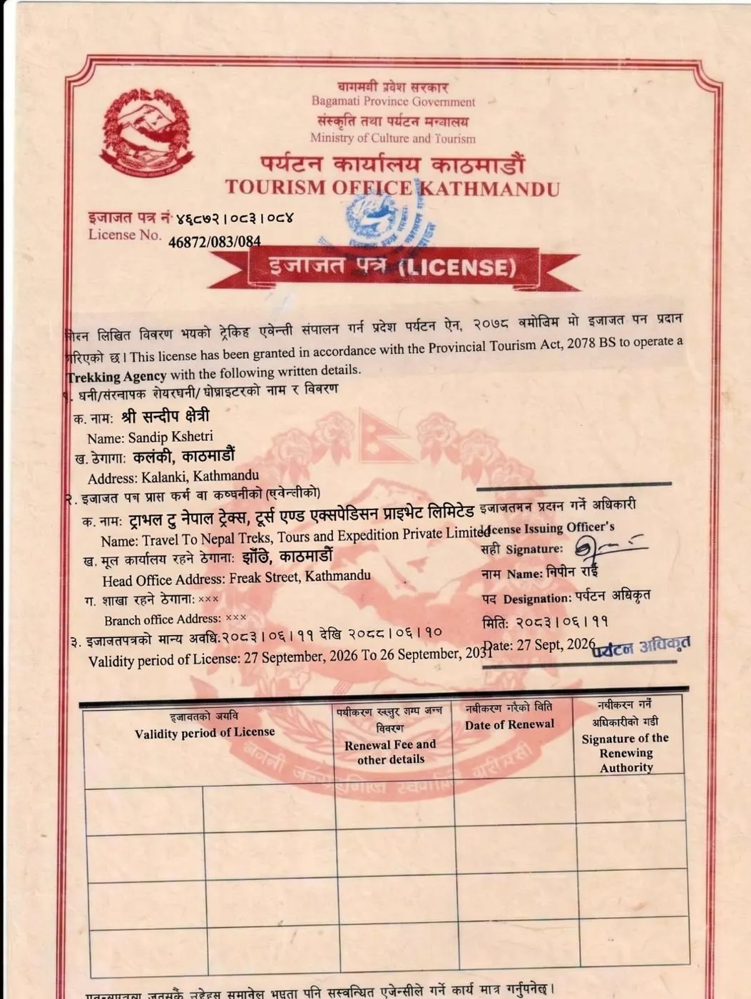
Official verification

Credentials and government licences

Est. 2025 · Kathmandu

Govt. reg.
Tourism Office Kathmandu
Tourism licence
46872/083/084

Nepal Department of Tourism registration certificateRegistration Tourism Office Kathmandu · licensed trekking agency

View full certificate

Fast reply on WhatsApp

Book your Annapurna Circuit Trek

Direct local pricing, no middlemen. Fill this in and we open WhatsApp with your request already written.

Trek

Annapurna Circuit Trek — 13 days

Send my request by email

Nothing is stored on this website.

Gear and essentials

Annapurna Circuit packing list

Keep your total pack weight between 9 and 12 kg. If you hire a porter, they carry up to 20 kg, which is usually shared between two trekkers, so about 10 kg each. You then carry only a 4-5 kg daypack.

Clothing and layering

  • Moisture-wicking T-shirts: 2 to 3 (short or long sleeve)

  • Thermal top and bottom: 1 to 2 pairs

  • Fleece jacket or pullover: 1

  • Light insulated jacket: 1 (optional, useful in November and spring)

  • Down jacket: 1

  • Waterproof pants & rain jacket: 1 pair

  • Sports bras: as required for you

  • Quick dry underwear: as required for you

  • Trekking pants: 2 pairs

  • Comfortable pants: 1 (for teahouse evenings)

Head, Hands, Socks, Footwear

  • Warm beanie or wool hat: 1

  • Sun hat or cap: 1 (with a wide brim)

  • Buffs or neck gaiters: 1 (for dust, wind and sun)

  • Thin liner gloves: 1

  • Insulated gloves: 1

  • Merino or synthetic trekking socks •: 4 to 5 pairs

  • Wool socks: 1 pair

  • Trekking boots: 1 pair (with good grip, waterproof mid or high-ankle)

  • Sandals / Light camp shoes: 1 pair (for teahouse night stay)

Bags, Backpacks, Sleeping Gear

  • Backpack: 45 to 55 Liter (with a padded hip belt) - without porter

  • Daypack: 25 to 35 Liter - with a porter

  • Duffel bag: 1 (we provide it for you free if you hire a porter)

  • Rain cover for backpack: 1

  • Zip pouch: 1 (for your passport, permits and cash)

  • Sleeping bag: 1 (comfort rating around -15°C)

  • Sleeping bag liner: 1 (for extra warmth and hygiene)

  • Small pillowcase: 1 (optional)

Toiletries and Personal Hygiene

  • Toothbrush, small toothpaste, biodegradable soap and shampoo: 1 each

  • Sunscreen SPF 50+, Moisturizer, Lip balm with SPF: 1

  • Wet wipes and hand sanitizer: 1

  • Toilet paper: 1 (you can buy in Manang also)

  • Feminine hygiene products: as required

  • Small trash bags: 1 (to carry your waste out)

  • Medicine: Altitude sickness, Painkillers, Anti-diarrhea, Antiseptic cream and wipes, Blister plasters and tape, Bandages and gauze, Antihistamines, Throat lozenges, Your Personal medicines

Trekking Equipment and Energy Food

  • Adjustable Trekking poles: 1 pair

  • Headlamp: 1 (with spare batteries for the early Tilicho & Thorong La starts)

  • Sunglasses with UV protection: 1 (category 3 or 4)

  • Microspikes: 1 pair (for snow & ice)

  • Small quick dry towel: 1

  • Water bottle / Hydration bladder: 2 liter total

  • Water purification tablets: 3 to 4 tablets per day

  • Energy Bars and Chocolate: 2 or 3 each day

  • Dry fruits and nuts: as required

  • Electrolyte powder or tablets: as required

Documents and Electronics

  • Passport: valid for at least 6 months

  • Passport-size photos: 2 to 4

  • Travel Insurance Documents: cover trekking to 5,500 m and helicopter rescue

  • NPR cash: NPR 4,000 to 5,000 per day for food and extras, plus 2 to 3 days extra

  • Power bank: 10,000 to 20,000 mAh

  • Charging cables and universal travel adapter: Nepal uses Type C, D and M sockets

  • Local SIM card: Nepal Telecom gives the best coverage

Practical field knowledge

Annapurna Circuit Trek Guide: season, teahouses, safety

Essential insights from our local Annapurna trek guides.

Best Season/Months

October, November, March and April are the best months for the Annapurna Circuit Trek. In these months, Thorong La is usually open, the skies are mostly clear, and the lodges are all running. May, September and December are also possible, but each has a clear downside. January, February and the monsoon months of June to August are the hardest times to trek.

  • March to April (Spring): Mostly clear mornings, windy afternoons; snow can still lie on Thorong La in March; nights at Thorong Phedi about -9°C to -7°C

  • May (Late spring): Warmer, but clouds build in the afternoon before the monsoon; pass usually clear of snow

  • June to August (Monsoon): Heavy rain in the lower valley, landslides on the Besisahar to Chame road, leeches; upper Manang and Mustang get much less rain

  • September (Early autumn): Monsoon ending, showers early in the month; storms can still hit the pass

  • October to November (Autumn): Clear, dry and stable; best mountain views; busiest season; nights at Thorong Phedi about -6°C in October and -10°C in November

  • December (Early winter): Clear and quiet, but very cold; snow can close Thorong La

  • January to February (Winter): Coldest months; deep snow often closes the pass; some high lodges may close

Autumn is the most popular season, with clean air and the sharpest mountain views. In Manang, October days reach about 13°C and nights about 0°C. Lodges at Tilicho Base Camp and Thorong Phedi fill up early. Storms still happen: in late September 2026, snow closed Thorong La for several days.

Spring is the second-best season, with warmer days and rhododendrons in bloom in April. Snow can stay on Thorong La into March, so carry microspikes and start each day early.

Winter is clear but cold. Nights at Thorong Phedi fall to about -13°C, and snow often closes the pass from December to March.

The monsoon (June to August) brings heavy rain, landslides on the jeep road and cloudy views. Upper Manang and Mustang stay much drier, but road travel is the main problem.

Pack for cold and wet weather in any season.

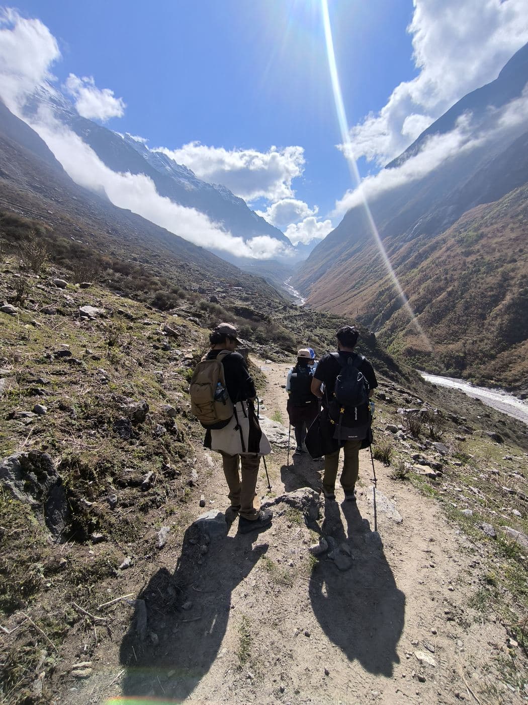
View from Chame, Best Season/Months, Annapurna Circuit Trek

Accommodation

You sleep in teahouses, small family-run lodges, every night of the Annapurna Circuit Trek. Every stop has at least a few lodges, but comfort changes a lot with altitude.

Lower villages (Besisahar to Manang)

  • Twin rooms with beds, mattresses, pillows and blankets

  • Some rooms with attached bathrooms; hot showers for a fee

  • Manang: the best lodges on the circuit, with 30+ lodges and hotels, warmer rooms and bakeries

  • Upper Pisang: 6 to 8 lodges plus Tibetan-style homestays, about USD 8 to 10 a room

High camps (above Manang)

  • Tilicho Base Camp: about 10 lodges

  • Thorong Phedi: only 2 to 3 lodges; Thorong High Camp: 1 to 2, the most basic stop on the circuit

  • Small wooden rooms or dorms with thin walls and no heating

  • Shared toilets, some outdoor pit or squat toilets

  • Limited hot water, at extra cost

After the pass

  • Muktinath (Ranipauwa): many lodges and pilgrim hotels, most with attached bathrooms, hot showers and grid power

  • Pokhara: a hotel near Phewa Lake

Good to know

  • Every teahouse has a dining hall, often heated by a stove in the evening, where you eat, warm up and charge devices.

  • Bedrooms are not heated, so bring a warm sleeping bag for the nights above Manang.

  • In peak season, we book rooms ahead at Tilicho Base Camp and Thorong Phedi, where beds are few.

Bhraka, Accommodation, Annapurna Circuit Trek

Food (and cost)

Budget around NPR 3,000 to 4,000 per day for food, or up to NPR 5,000 per day if you include hot showers, charging and hot water. Prices increase with altitude because supplies are carried by mules or porters.

Food options along the trail:

  • Lower Valley to Manang: Dal bhat, noodles, fried rice, momo, pasta, pizza, pancakes, eggs, potatoes and Tibetan bread. Manang also has bakeries and cafes serving coffee, apple pie and cinnamon rolls.

  • Above Manang: Food choices become more limited, mainly dal bhat, noodles, soups, potatoes, porridge, pancakes, eggs and tea.

  • After Thorong La Pass: Muktinath and Kali Gandaki villages offer wider menus again, including Thakali dal bhat and Marpha apple products.

Approximate food and facility prices:

  • Dal bhat: NPR 700 in the lower valley, NPR 1,300 in Manang and NPR 1,500 at Thorong Phedi or High Camp.

  • Hot shower: Around NPR 200 near Chame and up to NPR 600 at higher elevations, where it may not be available.

  • Charging: Around NPR 100–500 per device, depending on the lodge.

Useful tips:

  • Choose freshly cooked vegetarian meals above Manang.

  • Avoid alcohol until you have crossed Thorong La Pass.

  • Use boiled or filtered water and treat it before drinking.

  • Buy energy bars, nuts and chocolates in Kathmandu or Pokhara to save money.

*Winter (Dec–Feb) is clear but very cold at Kyanjin. The monsoon (Jun–Sep) brings rain, leeches and landslide risk on the road.

Alternative 11-Day Annapurna Circuit Itinerary (without Tilicho Lake)

This 11-day itinerary is the classic Annapurna Circuit without the Tilicho Lake side trip. It suits trekkers with less time, or anyone who wants to avoid the landslide zone on the Tilicho trail. The first six days are the same as the 13-day plan, including the acclimatization day in Manang. From Manang, you walk straight up to Yak Kharka.

Day 1: Kathmandu to Besisahar (7 hours drive)

Day 2: Besisahar to Chame (5–6 hours drive)

Day 3: Chame to Upper Pisang (5–6 hours)

Day 4: Upper Pisang to Ngawal via Ghyaru (4–5 hours)

Day 5: Ngawal to Manang (4 hours)

Day 6: Acclimatization Day in Manang – Ice Lake Hike (6–8 hours)

Day 7: Manang to Yak Kharka (3–4 hours)

Day 8: Yak Kharka to Thorong Phedi (4 hours)

Day 9: Thorong La Pass to Muktinath (9 hours)

Day 10: Muktinath to Pokhara (7 hours drive)

Day 11: Pokhara to Kathmandu (7 hours drive)

On Day 7 of this plan, you walk about 10 km from Manang to Yak Kharka, gaining about 510 m. The trail climbs steadily through Tanki Manang to Gunsang (about 3,900 m), then rises gently across yak pastures. It is a short day, which suits the rule of not sleeping too much higher each night.

Choose this itinerary if you are short on time. Keep in mind that you skip three nights above 4,000 m, so the Manang acclimatization day becomes even more important. If you feel unwell in Manang, add one more night there before you go on.

How to prevent Altitude Sickness during Annapurna Circuit Trek?

Altitude sickness is the main health risk on the Annapurna Circuit Trek, because you sleep above 3,500 m for eight nights, sleep above 4,000 m for four nights, and climb to 5,416 m on Thorong La. Altitude sickness, also called Acute Mountain Sickness (AMS), happens when you go up faster than your body can adjust to the thin air. It can affect anyone, fit or not.

How to prevent it:

  1. Climb gradually. Above 3,000 m, do not sleep much more than 300 to 500 m higher each night, and take a rest day after big jumps. Our itinerary has a rest day in Manang and three nights above 4,000 m before you reach Thorong Phedi.

  2. Climb high, sleep low. Use the Manang rest day to hike up to Ice Lake or a viewpoint, then come back down to sleep.

  3. Drink plenty of water, about 3 to 4 liters a day, including soups and tea.

  4. Avoid alcohol and sleeping pills until you are back down.

  5. Walk slowly. If you cannot talk while walking, slow down.

  6. Eat well, especially carbohydrates like dal bhat and potatoes, even if you are not hungry.

  7. Consider medication. Acetazolamide (Diamox) can help prevent AMS. Ask your doctor before the trip.

Know the early symptoms: headache, nausea, loss of appetite, dizziness, unusual tiredness.

Serious symptoms are a headache that painkillers do not stop, vomiting, confusion, trouble walking straight, a wet cough or breathlessness at rest. These can be signs of HACE (swelling of the brain) or HAPE (fluid in the lungs), which can kill within hours.

If serious symptoms appear, tell your guide at once, rest, and do not go higher until they are gone. If the symptoms become worse, go down at once, even at night. Going down 500 to 1,000 m is the best treatment.

The HRA aid post in Manang is the best medical help on the trek. In spring and autumn, it gives a free altitude talk every day at 3 PM and offers paid consultations.

Thorong La, Annapurna Circuit, How to prevent Altitude Sickness during Annapurna Circuit Trek?, Annapurna Circuit Trek

High Altitude Insurance for Annapurna Circuit Trek

Travel insurance that covers high-altitude trekking is essential for the Annapurna Circuit. Many standard travel policies stop at 3,000 m or 4,000 m, which would not cover you at Tilicho Lake (4,919 m) or on Thorong La (5,416 m).

Your policy should cover:

  • Trekking up to at least 5,500 m, since Thorong La sits at 5,416 m.

  • Emergency helicopter rescue and evacuation. A rescue flight in the Annapurna region costs about USD 5,000, and more with hospital costs.

  • Medical treatment and hospital costs in Nepal, and repatriation to your home country if needed.

  • Trip cancellation, interruption and delay, because landslides, snow on the pass and cancelled flights are common.

  • Loss or theft of baggage and valuables.

Read the conditions carefully. Some insurers require you to trek with a licensed guide, some exclude pre-existing medical conditions, and some need you to call their assistance line before any rescue. Note your policy number and the 24-hour emergency phone number, and send us a copy before the trek. We cannot arrange a helicopter rescue without your insurance details.

Tipping Tips for Annapurna Circuit Trek

Tipping is not required in Nepal, but it is a strong custom in trekking and an important part of guide and porter income. Many trekkers set aside about 10 to 15 percent of the trek cost for tips.

Suggested tip

Guide: USD 10 to 15 per day

Porter: USD 8 to 12 per day

Give tips at the end of the trek, in Pokhara or Kathmandu, in Nepali rupees or US dollars. Hand them to each person directly, in an envelope if you like.

Annapurna Circuit Trek Difficulty

The Annapurna Circuit Trek is rated challenging. It does not require technical climbing skills, but high altitude, long walking days, the Thorong La Pass crossing and the Tilicho landslide zone make it harder than many other teahouse treks in Nepal.

Difficulty by trekking stage:

  • Chame to Upper Pisang (2,670 to 3,300 m): 5 to 6 hours of walking. Moderate difficulty.

  • Upper Pisang to Ngawal to Manang (3,300 to 3,730 to 3,540 m): 4 to 5 hours to Ngawal, followed by 4 hours to Manang. Moderate difficulty, with a steep climb to Ghyaru.

  • Manang to Tilicho Base Camp (3,540 to 4,150 m): Around 7 hours. Moderate to hard, with a landslide-prone section.

  • Tilicho Base Camp to Tilicho Lake to Shree Kharka (4,150 to 4,919 to 4,060 m): Around 7 hours. Hard, with a steep zigzag climb to the lake.

  • Shree Kharka to Yak Kharka to Thorong Phedi (4,060 to 4,050 to 4,450 m): Around 7 hours to Yak Kharka and another 4 hours to Thorong Phedi. Moderate difficulty.

  • Thorong Phedi to Thorong La Pass to Muktinath (4,450 to 5,416 to 3,800 m): Around 9 hours. Very hard, with a long ascent followed by a steep descent that can be tough on your knees.

What makes the Annapurna Circuit Trek challenging?

  • High altitude: You spend seven nights at or above 3,540 m before crossing Thorong La Pass at 5,416 m. The oxygen available at the pass is roughly half that at sea level.

  • Long pass-crossing day: You usually start around 4 AM in freezing conditions, climb approximately 1,000 m and descend around 1,650 m in one day.

  • Tilicho Lake: The route includes a narrow landslide-prone section and a steep climb of around 800 m to reach the lake.

  • Cold temperatures: Nights above Manang can drop below freezing during autumn and spring.

  • Weather conditions: Heavy snowfall can temporarily close Thorong La Pass, while landslides can block road sections.

With good physical fitness, a steady walking pace and enough time for acclimatization, most reasonably fit trekkers can manage this trek. The 11-day Annapurna Circuit itinerary without Tilicho Lake is a little easier and involves less walking.

Route through 2 regions

Regions on this route

This trek starts in Annapurna Region and ends in Mustang Region. Each region has its own landscape, permits and best season.

  1. Annapurna Region
  2. Mustang Region
  1. Starts here

    Region 1: Annapurna Region

    Gurung hill villages, the Annapurna Sanctuary and Tibetan-style Manang and Nar Phu, all inside Nepal's first and largest conservation area.

    Highest point
    8,091 m
    Difficulty
    Easy–challenging
    Permits
    ACAP + Nar Phu RAP (
    Explore the Annapurna Region region
  2. Ends here

    Region 2: Mustang Region

    Explore the Last Forbidden Kingdom of the Himalayas: ancient sky caves, walled Lo Manthang & timeless Tibetan culture.

    Highest point
    7,061 m
    Difficulty
    Easy–challenging
    Permits
    ACAP + RAP
    Explore the Mustang Region region

Best months along the route

  • Best
  • Possible
  • Not ideal
RegionJanFebMarAprMayJunJulAugSepOctNovDec
Annapurna RegionPossiblePossibleBestBestBestPossiblePossiblePossiblePossibleBestBestPossible
Mustang RegionNot idealNot idealBestBestBestPossiblePossiblePossibleBestBestBestPossible
Whole routeNot idealNot idealBestBestBestPossiblePossiblePossiblePossibleBestBestPossible

Each month on the route is only as good as its worst region. The start-date picker uses the whole route's months.

Frequently asked questions for the Annapurna Circuit Trek

General information

What is the highest point of the Annapurna Circuit?

Thorong La at 5,416 m (17,769 ft). You cross it on day 11 and sleep the same night at Muktinath (3,800 m).

When is the best time to trek the Annapurna Circuit?

October and November for the most stable weather on the pass, and April to May. In March and from December, snow can close Thorong La for days at a time.

Itinerary and duration

How long does the Annapurna Circuit take?

Our itinerary is 16 days from Kathmandu and back, with 11 nights on the trek. Starting the walk lower down, or adding Tilicho Lake, takes a few days more.

Is there a road on the Annapurna Circuit?

Yes, jeep roads now reach Manang on the east side and Muktinath on the west. We drive the lower part and walk quieter trails, such as the high route through Ghyaru and Ngawal, wherever they exist.

Trek difficulty and fitness

How difficult is the Annapurna Circuit?

Challenging, grade 4 of 5. It is long, and the pass day is 8–10 hours at high altitude. No climbing skills are needed, but you should be fit and used to multi-day walking.

Is Thorong La dangerous?

Thorong La is a long, high day but not technical. The risks are altitude and weather. We acclimatise in Manang, climb slowly, and your guide decides on the day whether it is safe to cross.

Permits, altitude and safety

Which permits do I need?

The Annapurna Conservation Area Permit (ACAP), and a TIMS card where checkpoints ask for it. We arrange both before you arrive. Nepal requires foreign trekkers to walk with a licensed guide arranged through a registered agency. All our treks include one.

How do you prevent altitude sickness?

A rest day in Manang, short days to Yak Kharka and Thorong Phedi, pulse and oxygen checks every evening, plenty of fluids, and going down at once if serious symptoms appear.

Fast reply · local operator

Ready for the Himalaya?

Book the Annapurna Circuit with us

Get a personal itinerary, packing advice and a confirmed price for your group, straight from our Kathmandu team.

Send my request by email

Nothing is stored on this website.

Explore more of the Himalaya

Similar trekking options in Nepal

Treks planned with you and led by local guides.

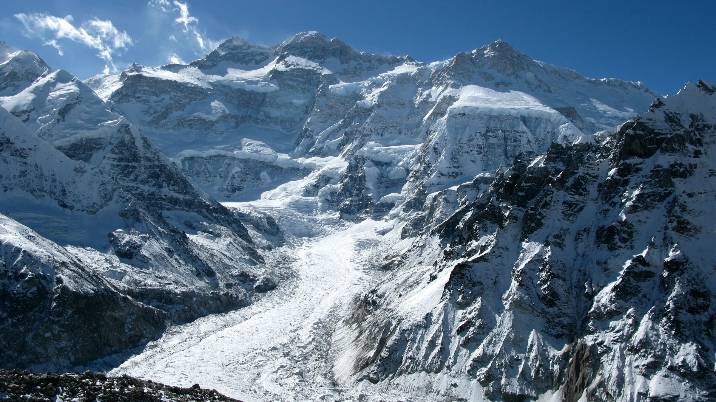
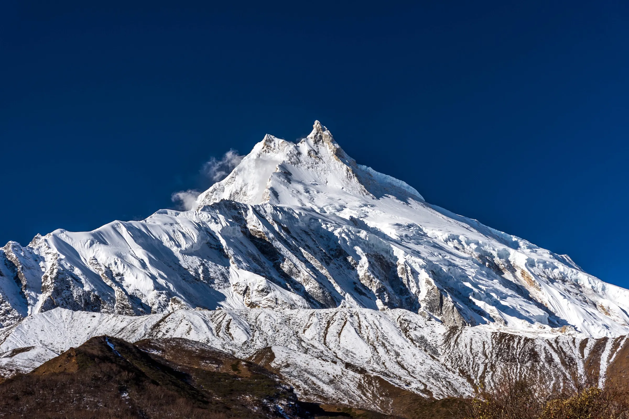
  • Manaslu, Manaslu Circuit TrekManaslu Region

    13 days · Challenging

    Manaslu Circuit Trek

    A wild circuit around Manaslu, the world's eighth-highest mountain, over the Larkya La (5,106 m) with far fewer trekkers.

  • Nar Phu valley, Nar Phu Valley Trek 10 DaysAnnapurna Region

    12 days · Challenging

    Nar Phu Valley Trek 10 Days

    Nar Phu Valley Trek: 10-day itinerary from Koto to Ngawal via Kang La Pass (5,320 m), with permit costs, package price, tips and a full trek guide.

  • Annapurna Base Camp TrekAnnapurna Region

    11 days · Moderate

    Annapurna Base Camp Trek

    Gurung villages, rhododendron forest and a night inside the Annapurna Sanctuary at 4,130 m.

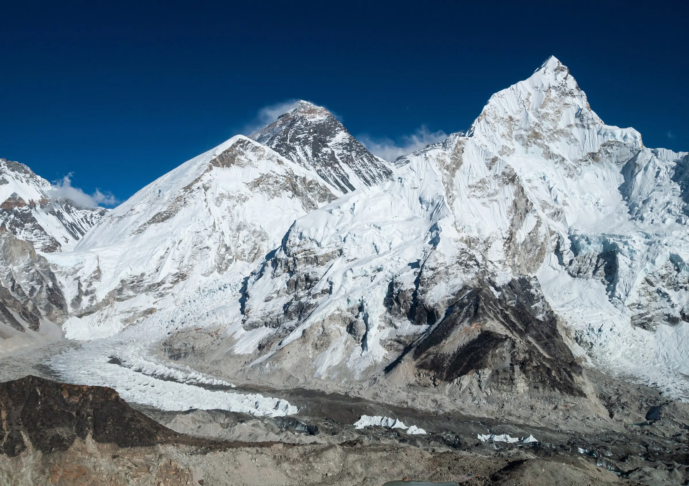
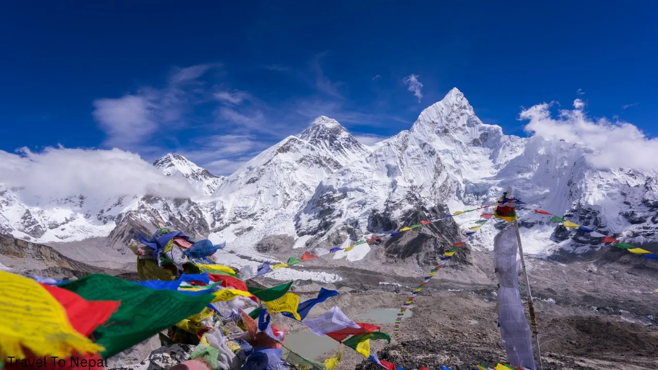
  • Everest, Nuptse and the Khumbu Glacier, Everest Base Camp TrekEverest Region

    14 days · Challenging

    Everest Base Camp Trek

    Sherpa villages, Tengboche monastery and a sunrise on Kala Patthar facing Everest.

Sign up for our newsletter

Seasonal trail updates, packing guides and new treks, about once a month.

We send a confirmation email first. Unsubscribe any time.

From$550